

Not all clouds fit neatly into the ten main genera. Some appear as distinctive features or as by-products of atmospheric processes.
Together, these forms provide visual evidence of atmospheric motion, turbulence, or human activity, and while less common than the main genera, they are important signals for weather observers and forecasters.
-
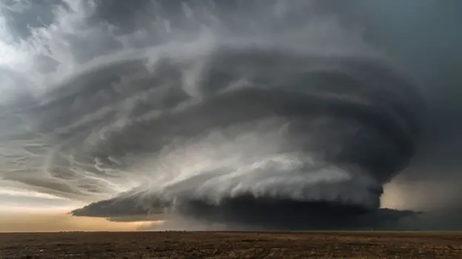
Arcus Clouds
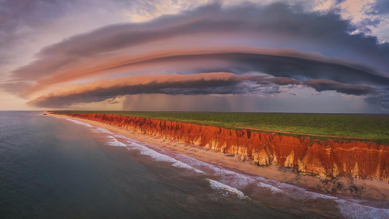
Arcus clouds are dramatic, low-level horizontal formations that appear along the leading edges of thunderstorms or gust fronts. They occur in two principal forms: shelf clouds and roll clouds.
-
Asperitas Clouds
Asperatus clouds, also known as Undulatus Asperatus, are one of the most visually dramatic and recently recognised cloud formations. Their bases resemble a dark, rolling ocean seen from beneath, giving the sky a sense of movement and texture.
-
Cauda Clouds
Cauda clouds are a distinctive feature associated with severe thunderstorms, particularly supercells. These low-level, horizontal, tail-shaped clouds extend from the main precipitation region of a supercell cumulonimbus cloud to the murus (wall cloud).
-
Cirrus Homogenitus Clouds (Contrails)
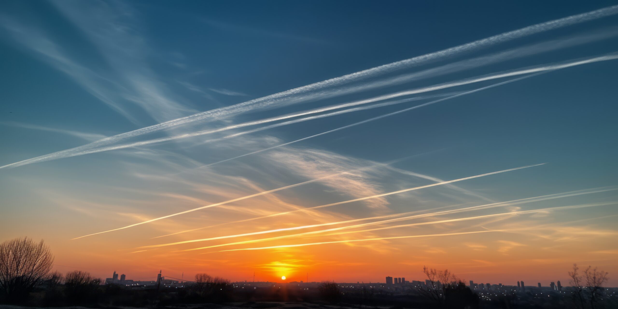
Cirrus homogenitus, more commonly known as contrails, are artificial ice clouds formed by aircraft exhaust in the upper troposphere and lower stratosphere. These streaks of vapour trail behind jet engines and resemble thin, fibrous cirrus clouds.
-
Fallstreak or Hole-Punch Clouds
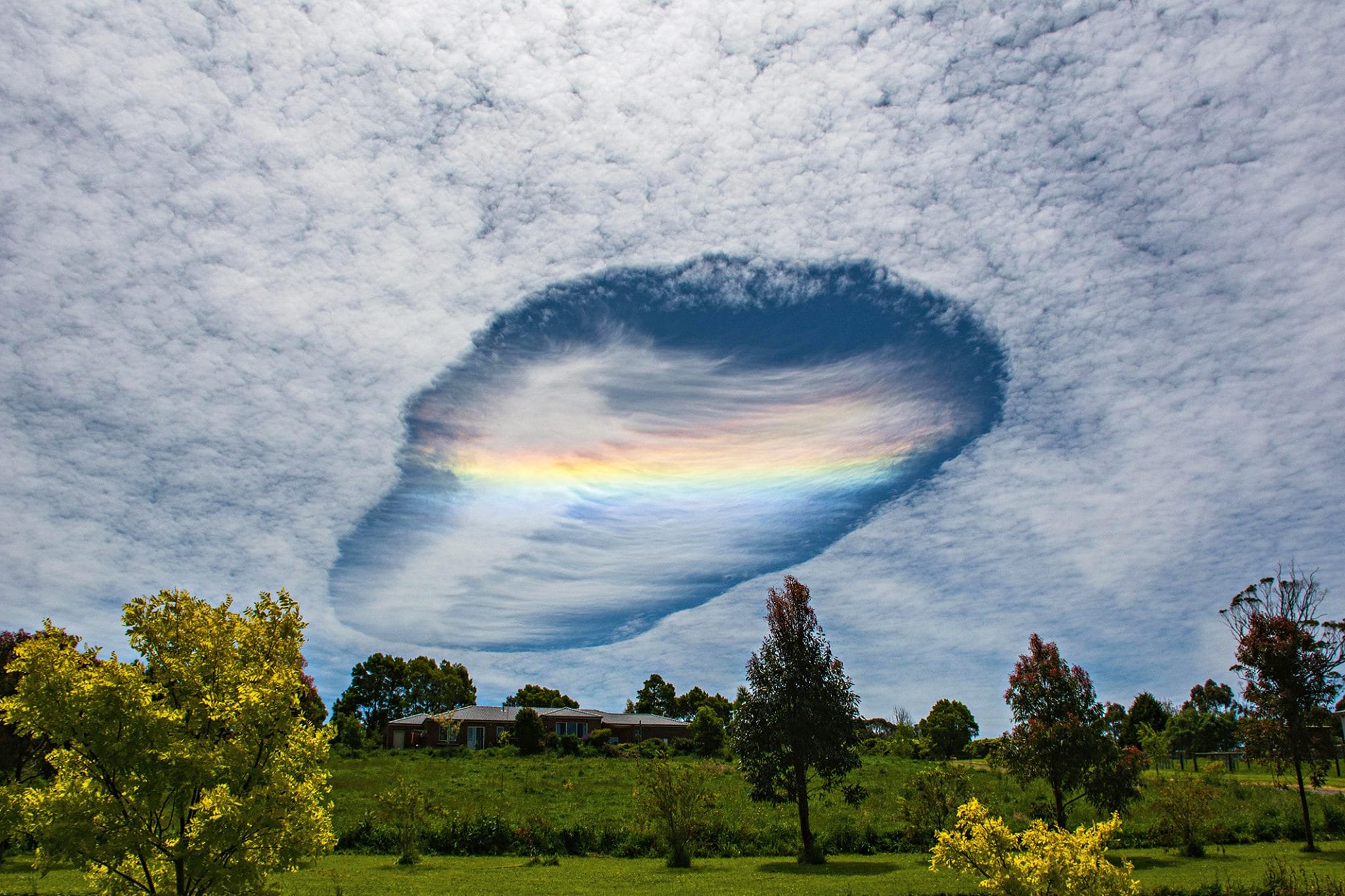
Fallstreak or hole-punch clouds are circular or elliptical gaps in mid-level cloud layers caused by aircraft penetration through supercooled cloud decks.
-
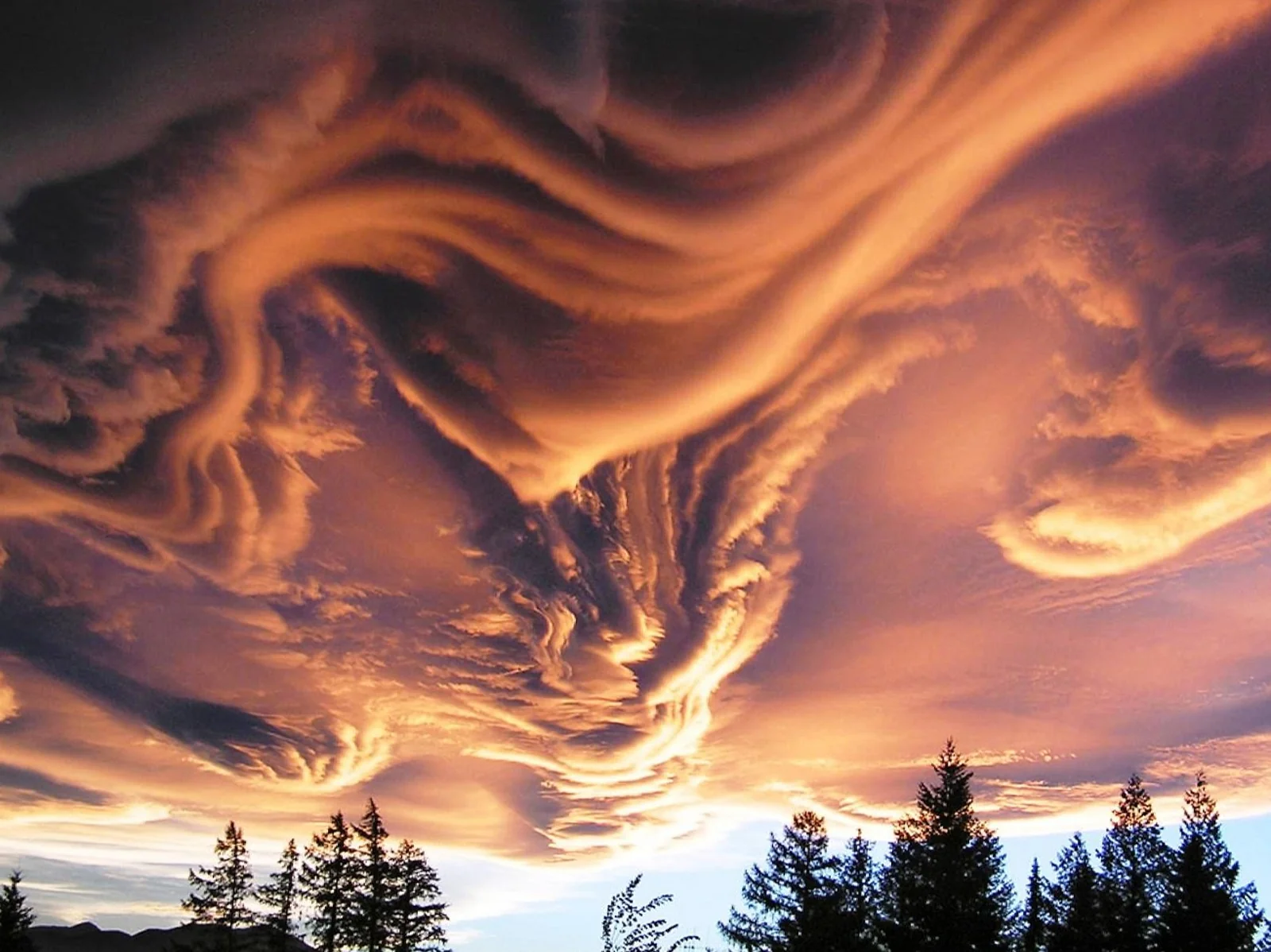
Fluctus Clouds (Kelvin-Helmholtz Clouds)
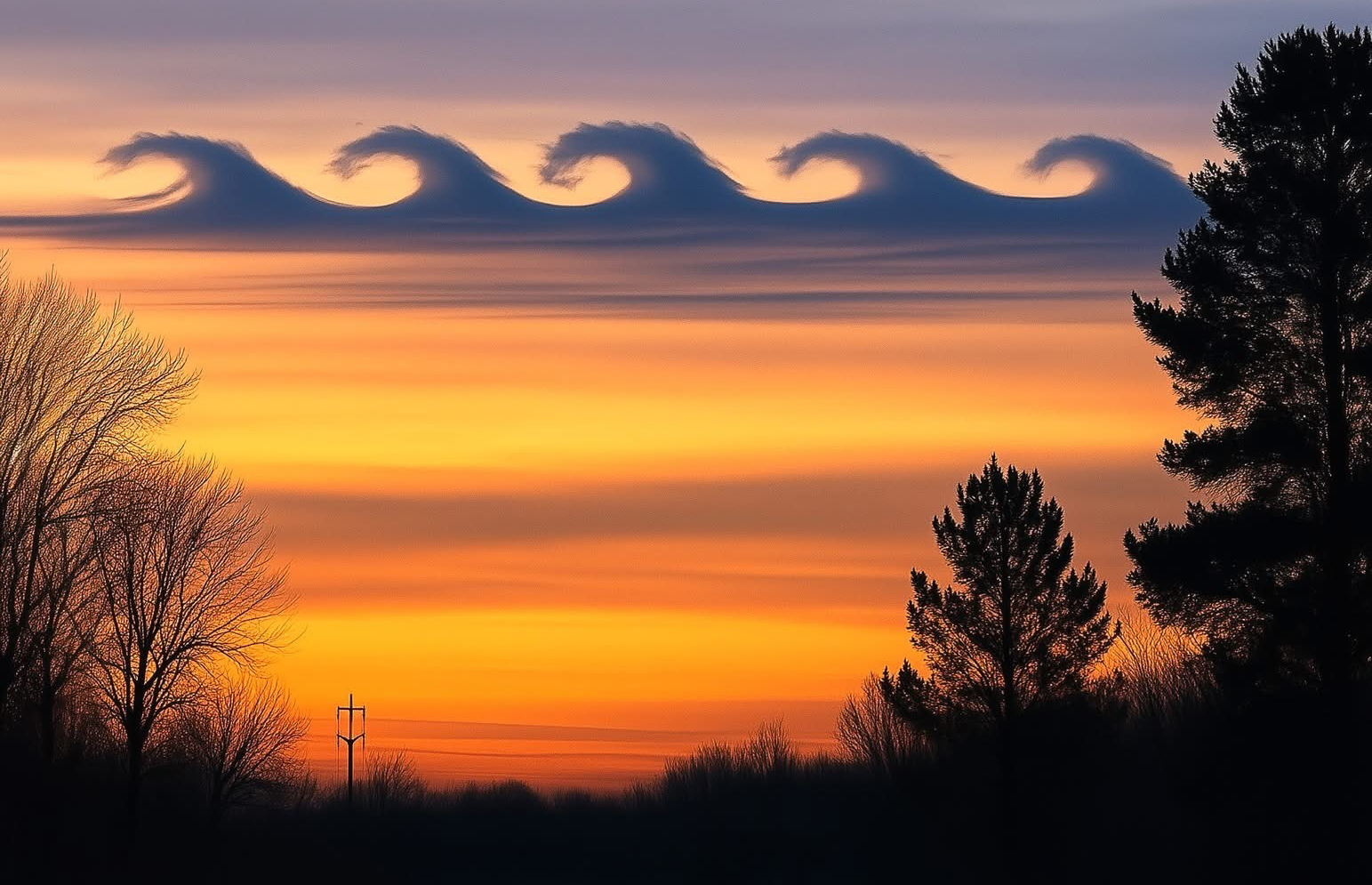
Fluctus clouds, commonly known as Kelvin-Helmholtz clouds, are visually striking cloud formations that resemble breaking ocean waves suspended in the atmosphere. These clouds are a type of instability cloud, formed when layers of air move at different speeds or densities, creating a rolling, wave-like pattern. They are usually small, transient, and found at low to mid-level altitudes, often appearing above other cloud layers. Their unusual, undulating structure makes them one of the most recognisable examples of atmospheric shear in action. Characteristics of Fluctus Clouds (Kelvin-Helmholtz Clouds) Formation and Dynamics of Fluctus Clouds (Kelvin-Helmholtz Clouds) Fluctus clouds form as a result…
-
Fractus Clouds
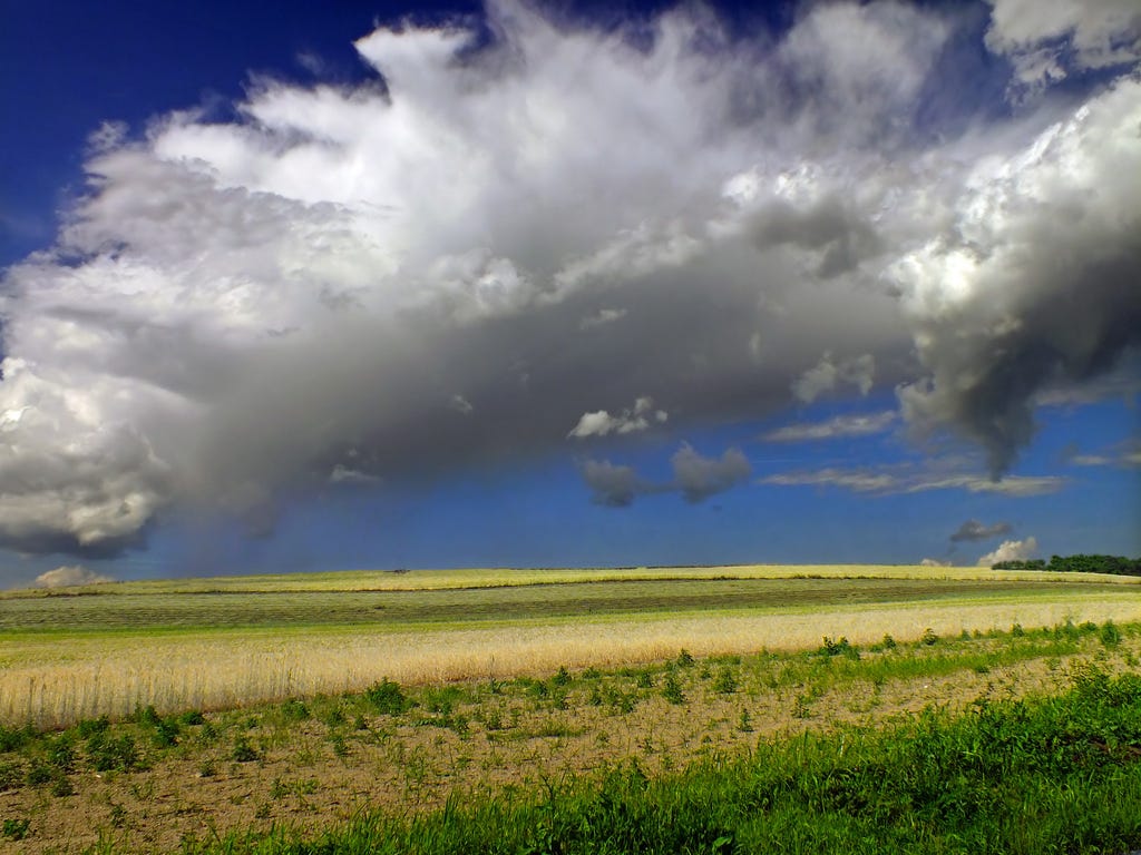
Fractus clouds are small, irregular fragments that break away from larger cloud masses. They often form beneath precipitating clouds or along gust fronts, moving rapidly and constantly changing shape.
-
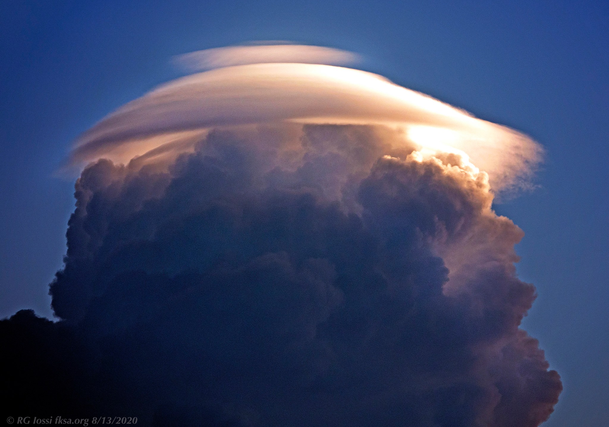
Lenticular Clouds
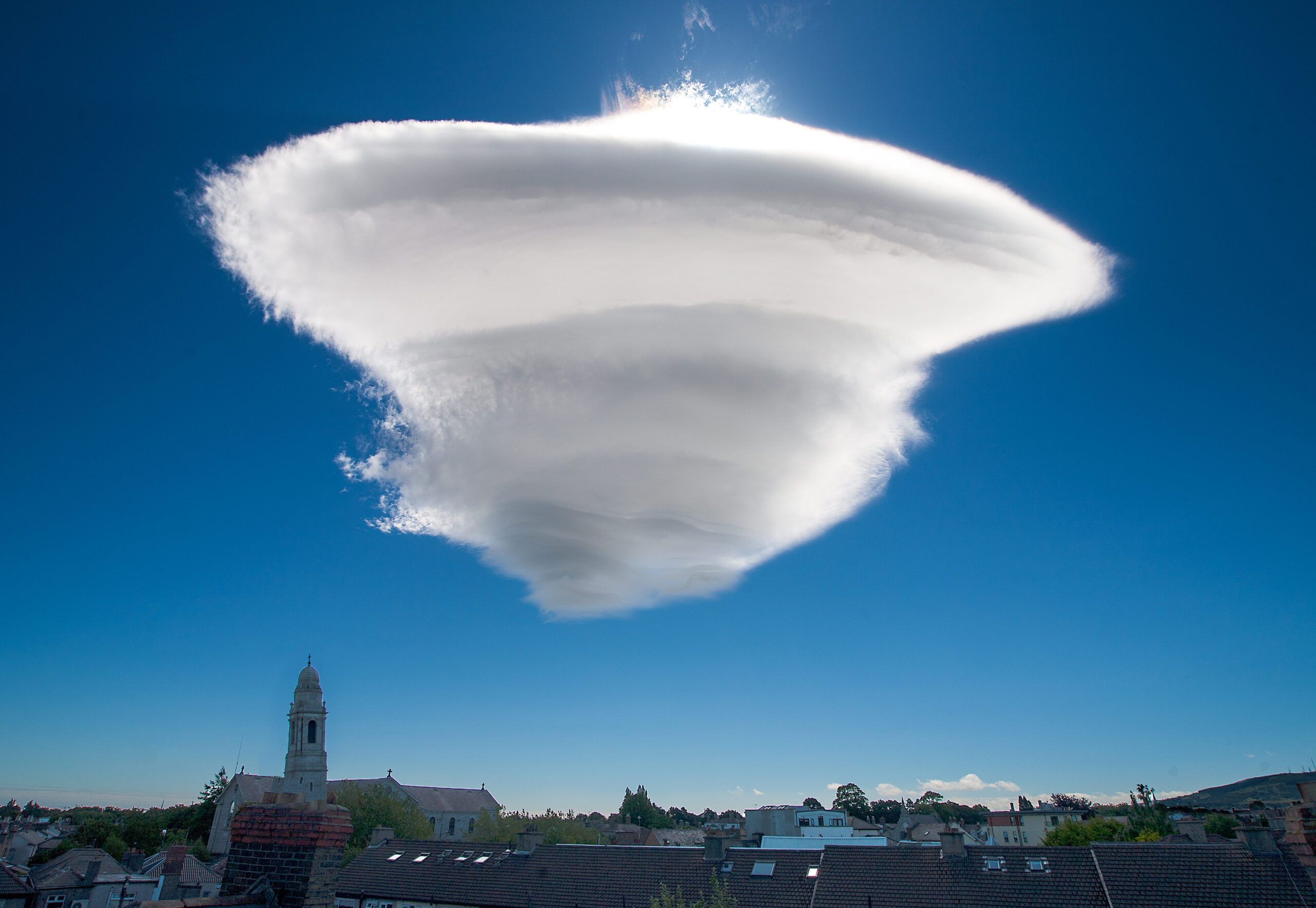
Lenticular clouds are smooth, lens-shaped formations that develop when stable, moist air flows over mountain ranges or obstacles. They are classified within the altocumulus or cirrocumulus genera
-
Mammatus Clouds
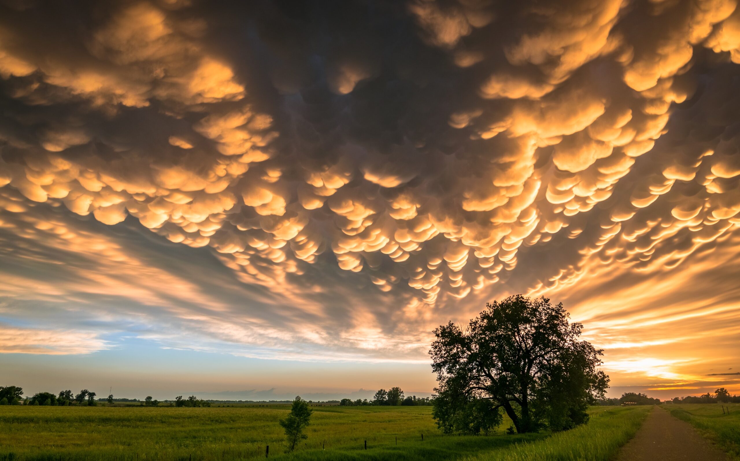
Mammatus clouds are pouch-like protrusions hanging beneath the anvil of cumulonimbus clouds or, more rarely, other cloud types. They mark areas of intense downdraft and are striking indicators of turbulent atmospheric processes.
-
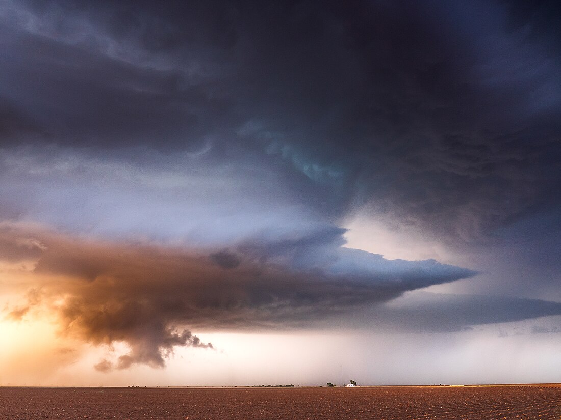
Murus Clouds
Murus clouds, commonly referred to as wall clouds, are dramatic, vertically oriented cloud features that form beneath the base of a severe thunderstorm, usually a supercell cumulonimbus cloud. They are characterised by a concentrated, lowering base that can rotate and serve as a precursor to tornado formation.
-
Nacreous Clouds: Polar Stratospheric Iridescence

Nacreous clouds, also known as polar stratospheric clouds (PSCs), are high-altitude clouds that form in the stratosphere, typically between 15,000 and 25,000 metres above the surface. They are most commonly observed in polar regions during winter months
-
Noctilucent Clouds
Noctilucent clouds, also called night-shining clouds, are the highest clouds in the Earth’s atmosphere, forming in the mesosphere at altitudes of approximately 76 to 85 kilometres. They are primarily composed of ice crystals.
-
Pileus Clouds
Pileus clouds, often called cap clouds, form as thin, smooth layers over the tops of rapidly growing cumulus or cumulonimbus towers. They signify vigorous updrafts and rapid vertical development in convective systems.
-
Undulatus Clouds
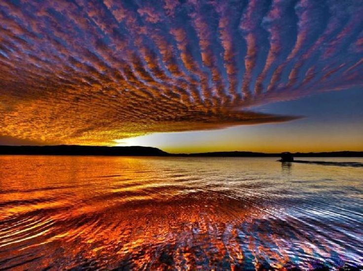
Undulatus clouds are a recognised cloud variety characterised by wave-like patterns across the sky. The term undulatus is Latin for “wavy,” reflecting the repeating bands or ripples these clouds display. They are observed within multiple cloud genera, including Altocumulus, Stratocumulus, and Cirrocumulus.
-
Virga Clouds
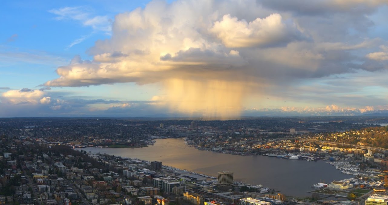
Virga clouds describe the visual effect of precipitation falling from a cloud but evaporating or sublimating before reaching the surface. The result is a pattern of vertical or slanting streaks extending beneath the parent cloud.
-
Volutus Clouds

Volutus clouds, commonly known as roll clouds, are a type of Arcus Cloud. They are rare, low-level cloud formations characterized by their distinctive tube-like shape and horizontal orientation. They typically appear detached from other cloud systems and exhibit a rolling motion along a horizontal axis.

