

Nacreous clouds, also known as polar stratospheric clouds (PSCs), are high-altitude clouds that form in the stratosphere, typically between 15,000 and 25,000 metres above the surface.
They are most commonly observed in polar regions during winter months, when temperatures drop below −78°C.
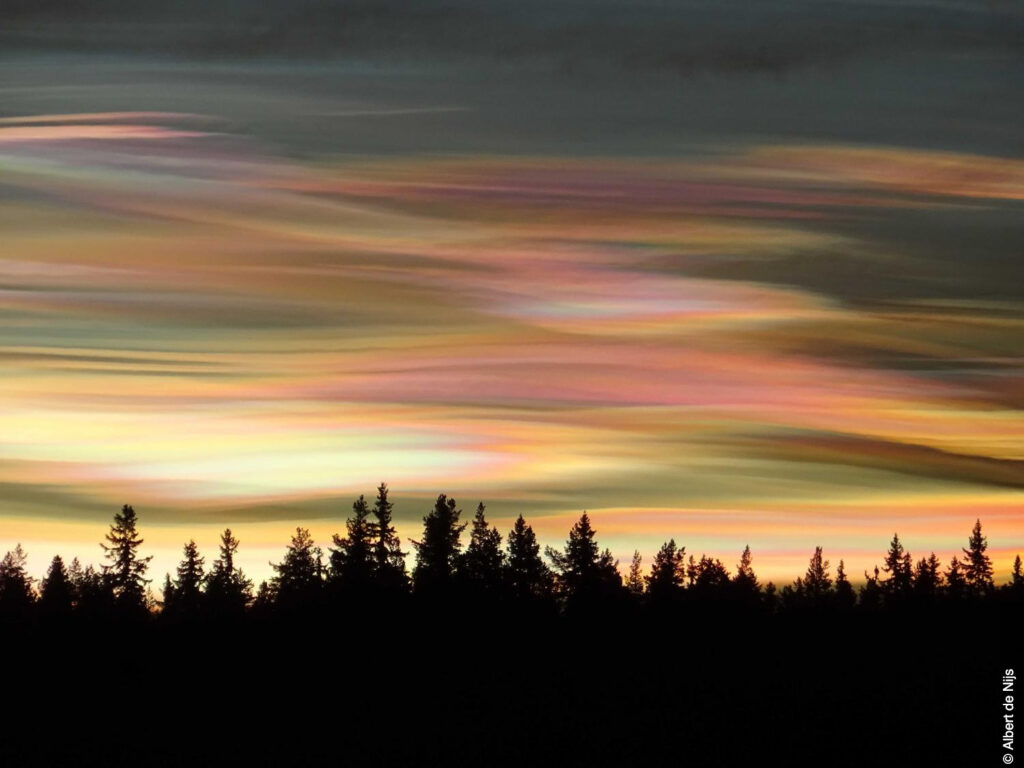
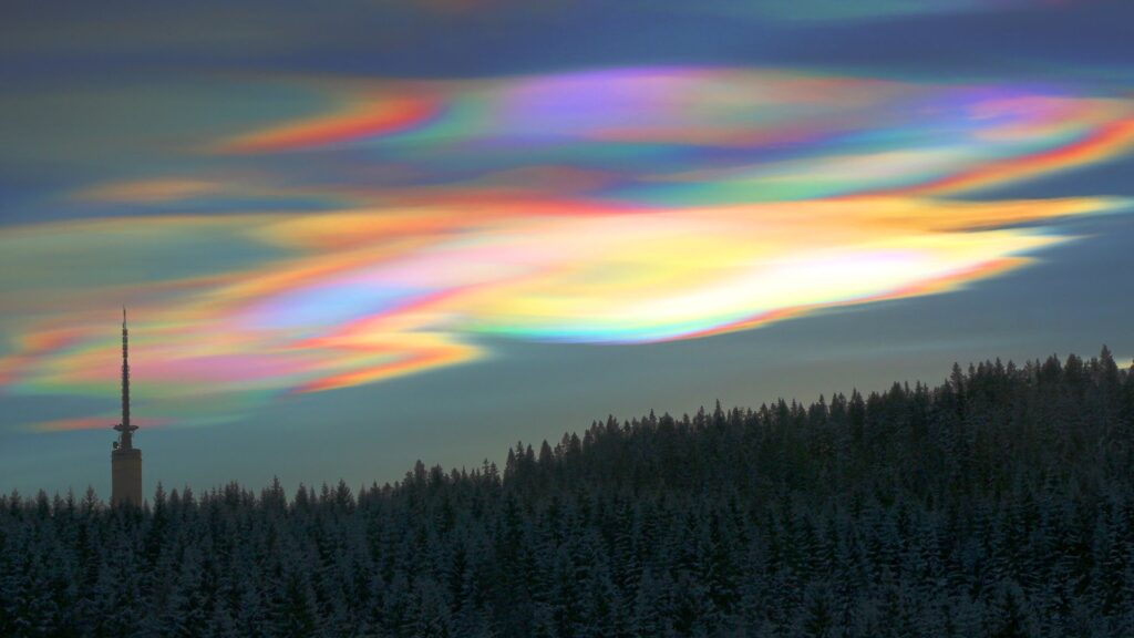
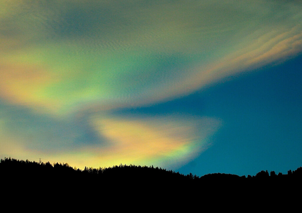
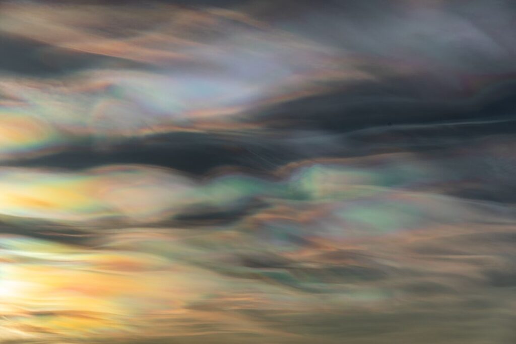
Nacreous clouds are known for their iridescent, pearly colours, which result from the diffraction of sunlight through tiny ice crystals.
These clouds are significant in atmospheric science because they play a role in stratospheric ozone depletion.
Characteristics of Nacreous clouds
- Base Altitude: Nacreous clouds form at 15,000 to 25,000 metres, well above the troposphere, in the stratosphere.
- Top Altitude: Their vertical extent is limited, typically hundreds of metres, appearing as thin layers or sheets across the sky.
- Shape: Nacreous clouds appear as thin, smooth, layered sheets or wavy formations. They can cover large horizontal expanses and are often observed near the horizon.
- Texture: These clouds are usually smooth or slightly rippled, with a translucent quality that allows the sun to illuminate them.
- Colour: Nacreous clouds display intense iridescence, with colours ranging from pale pinks and greens to vivid purples and blues, caused by light diffraction through microscopic ice crystals.
- Etymology: The term nacreous comes from Latin nacrare, meaning “pearly”, reflecting the shimmering, pearl-like appearance of the clouds.
- Precipitation: Nacreous clouds do not produce precipitation. They consist of tiny supercooled ice particles, and due to their extreme altitude and low temperatures, any precipitation would sublimate before reaching lower layers of the atmosphere.
Formation and Dynamics
Nacreous clouds form under extremely cold stratospheric conditions, typically in polar regions during winter. The formation process requires:
- Extremely low temperatures below −78°C.
- Moisture sufficient to allow deposition of ice on tiny aerosol particles.
- Stable stratospheric layers, allowing thin, well-defined cloud sheets to persist.
These clouds are categorized into two main types based on composition:
- Type I PSCs: Composed of nitric acid and water ice, forming at temperatures below −78°C.
- Type II PSCs: Composed of pure water ice, forming at temperatures below −85°C.
The iridescence is caused by diffraction and interference of sunlight through the uniform ice crystals, creating spectacular colour bands.
Historical Context
Nacreous clouds were first documented in polar regions during the 19th century, with early accounts describing “pearly skies” in winter.
Their scientific significance became clear in the 20th century, particularly regarding their role in ozone depletion.
The clouds provide a surface for chlorine and bromine reactions, which catalyze the destruction of ozone molecules during polar winter and spring.
Observations of nacreous clouds are rare outside polar regions due to the extreme temperature requirements.
Advances in satellite imagery and ground-based photography have improved understanding of their distribution, frequency, and seasonal dynamics.
Observations and Phenomena
- Visual Phenomena: Nacreous clouds are visible during civil twilight, when the sun is below the horizon but still illuminates the stratosphere.
- Atmospheric Significance: These clouds contribute to the formation of polar stratospheric ozone holes by providing surfaces for chemical reactions involving chlorine and bromine compounds.
- Geographic Occurrence: Predominantly observed in Antarctica and the Arctic, particularly between 65° and 75° latitude during winter months.
Distinguishing Nacreous from Similar Clouds
- Noctilucent Clouds: These form at higher altitudes in the mesosphere (~80 km) and occur primarily during summer. Nacreous clouds are lower in altitude and occur in winter.
- Cirrus Clouds: While cirrus clouds also consist of ice crystals, they form in the upper troposphere and are generally less iridescent than nacreous clouds.
- Altostratus/Altocumulus: These mid-level clouds lack the extreme altitude and iridescent colouring of nacreous clouds.
Further Information on Nacreous clouds
- Scientific Importance: Nacreous clouds are studied for their impact on stratospheric chemistry, particularly in relation to ozone depletion mechanisms.
- Observation Techniques: Ground-based polar photography, spectroscopy, and satellite monitoring are used to capture cloud morphology and assess their role in chemical reactions.
- Rarity: Due to the specific conditions required for formation, sightings are limited to polar winter months and are considered a reliable indicator of extremely low stratospheric temperatures.
Nacreous clouds are high-altitude, iridescent clouds formed under extreme polar stratospheric conditions.
They serve as indicators of stratospheric temperature and humidity and play a role in ozone chemistry.
Although visually striking, their primary significance lies in their contribution to polar atmospheric processes, providing insight into the dynamics of the upper atmosphere and chemical interactions affecting ozone.

