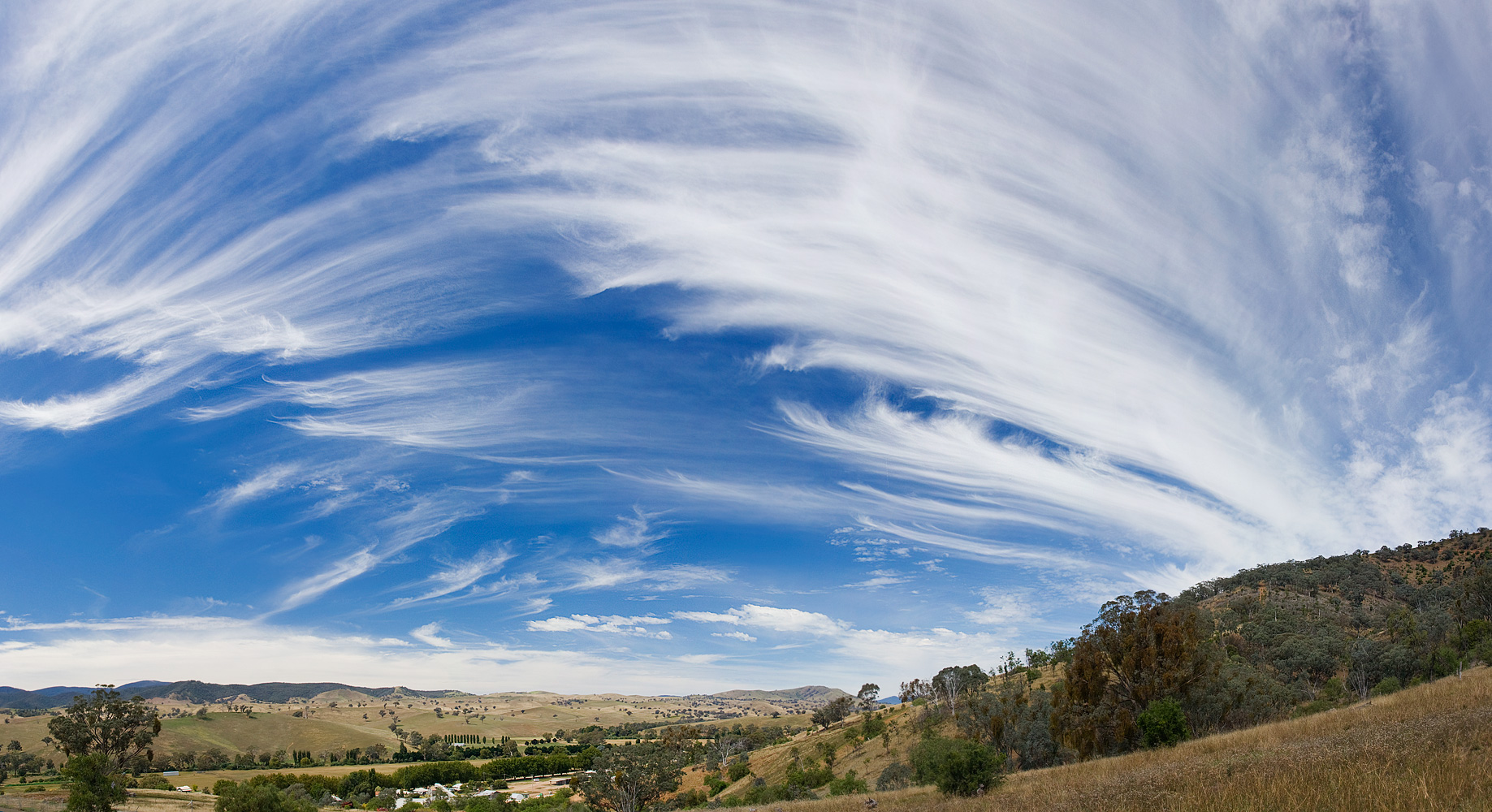

Fluctus clouds, commonly known as Kelvin-Helmholtz clouds, are visually striking cloud formations that resemble breaking ocean waves suspended in the atmosphere.
These clouds are a type of instability cloud, formed when layers of air move at different speeds or densities, creating a rolling, wave-like pattern.
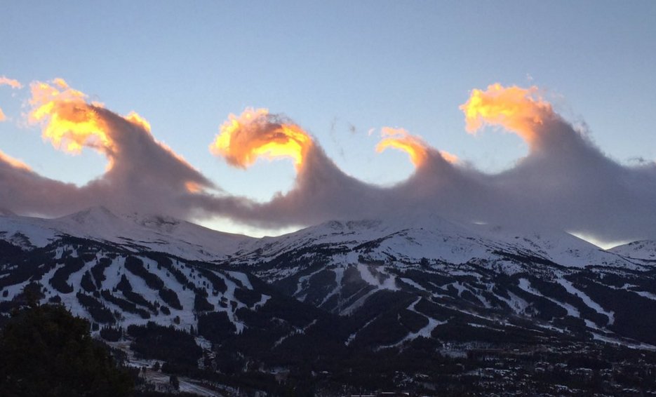
They are usually small, transient, and found at low to mid-level altitudes, often appearing above other cloud layers.
Their unusual, undulating structure makes them one of the most recognisable examples of atmospheric shear in action.

Characteristics of Fluctus Clouds (Kelvin-Helmholtz Clouds)
- Base Altitude: Fluctus clouds typically form at low to mid-level altitudes, generally between 1,000 and 6,000 metres, depending on the stability of the atmosphere.
- Top Altitude: The wave structures are usually thin, so the vertical extent is limited, often only hundreds of metres.
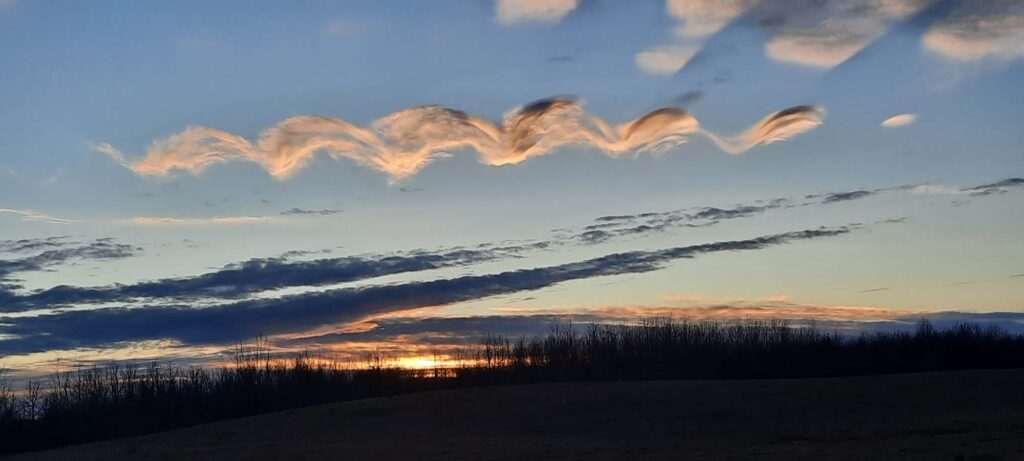
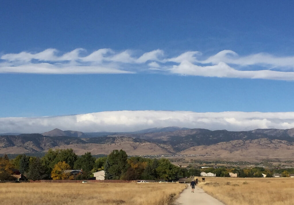
- Shape: The defining characteristic of Fluctus clouds is their rolling, wave-like pattern, reminiscent of ocean surf. Each “wave” appears to break over the next, creating a visually dramatic ripple effect.
- Texture: These clouds are often smooth on top, with sharply defined edges that highlight the shear interface between moving air layers.
- Color: They are usually white or light gray, with shadows and highlights enhancing the illusion of waves, particularly in low sunlight.
- Etymology: The term “Fluctus” comes from the Latin word for “wave” or “flow”, reflecting the cloud’s characteristic undulating form. They are also widely referred to as Kelvin-Helmholtz clouds, named after the physicists Lord Kelvin and Hermann von Helmholtz, who studied the instabilities that generate these wave patterns.
- Precipitation: Fluctus clouds do not produce rainfall themselves. They are instability features, forming above other cloud layers or in clean air, and are too thin to create significant precipitation.
Formation and Dynamics of Fluctus Clouds (Kelvin-Helmholtz Clouds)
Fluctus clouds form as a result of Kelvin-Helmholtz instability, a physical phenomenon that occurs when two layers of air move at different velocities.
The faster-moving layer slides over the slower one, creating rolling motions along the interface. This process leads to the formation of the characteristic wave crests and troughs.
These clouds are most often seen above stable cloud layers, such as stratocumulus or altocumulus clouds, where the shear is strongest.
They are transient, lasting from a few minutes to tens of minutes, before dissipating as the airflow stabilises.
The visibility of Fluctus clouds depends on humidity, wind shear, and cloud condensation nuclei, which together define the wave’s structure and sharpness.

Historical Context
Kelvin-Helmholtz clouds have fascinated observers for centuries. Early sketches and paintings of wave-like cloud formations exist in European art from the 17th and 18th centuries, although they were not scientifically classified at the time.
The formal scientific explanation arose in the 19th century through studies of fluid dynamics by Lord Kelvin and Hermann von Helmholtz, who mathematically described shear instabilities in fluids, directly applying these concepts to atmospheric phenomena.
In modern meteorology, Fluctus clouds are recognised as instability or shear clouds, catalogued as a supplementary feature in the International Cloud Atlas.
Observations and Phenomena
- Wave Height and Frequency: The wave pattern in Fluctus clouds can vary from a few metres to several tens of metres between crests, depending on wind shear intensity.
- Locations: They are observed worldwide but are particularly visible where stable lower cloud layers are topped by faster-moving air, such as coastal regions and over mountain ranges.
- Visual Appeal: The wave-like motion is often described as “clouds breaking like the ocean”, and their rarity makes them highly sought after by photographers and cloud enthusiasts.
Distinguishing Fluctus from Similar Cloud Forms
- Asperitas Clouds: Asperitas clouds also show wavelike undulations, but they lack the sharply defined crests and are more chaotic in appearance.
- Undulatus Clouds: Undulatus clouds exhibit horizontal ripples, but these are smaller amplitude and more regular, while Fluctus clouds create a dramatic rolling effect resembling breaking waves.
- Lenticular Clouds: Lenticular clouds are smooth, lens-shaped clouds over mountains; unlike Fluctus clouds, they do not display the rolling wave crests caused by wind shear.
Further Information
- Scientific Significance: Fluctus clouds provide visual confirmation of atmospheric shear and turbulence, and are studied in meteorology to understand wave propagation in stratified air.
- Transience: These clouds are short-lived, often forming and dissipating within minutes, which highlights the dynamic nature of the lower atmosphere.
- Impact on Aviation: While Fluctus clouds themselves are harmless, they indicate wind shear aloft, which can be of interest to pilots and glider enthusiasts.
Fluctus clouds, or Kelvin-Helmholtz clouds, are a spectacular demonstration of atmospheric physics.
Their rolling, wave-like appearance reflects dynamic shear instabilities between air layers and showcases the complexity of the lower and mid-level atmosphere.
Though rare and transient, these clouds captivate observers and scientists alike, combining beauty and meteorological significance in a single striking formation.