
Noctilucent Clouds are High-Altitude Ice Crystals
Noctilucent clouds (NLCs), also called night-shining clouds, are the highest clouds in the Earth’s atmosphere, forming in the mesosphere at altitudes of approximately 76 to 85 kilometres.
They are primarily composed of ice crystals and are visible during twilight hours when the Sun is below the horizon but illuminates these upper-atmosphere clouds.
Noctilucent clouds are largely restricted to high-latitude regions during the summer months and are indicators of extreme atmospheric conditions in the mesosphere.
Characteristics of Noctilucent Clouds
- Base Altitude: 76–85 kilometres, in the mesosphere, making them far higher than tropospheric clouds.
- Top Altitude: They are relatively thin, with vertical extent typically less than a kilometre, forming thin, layered sheets.
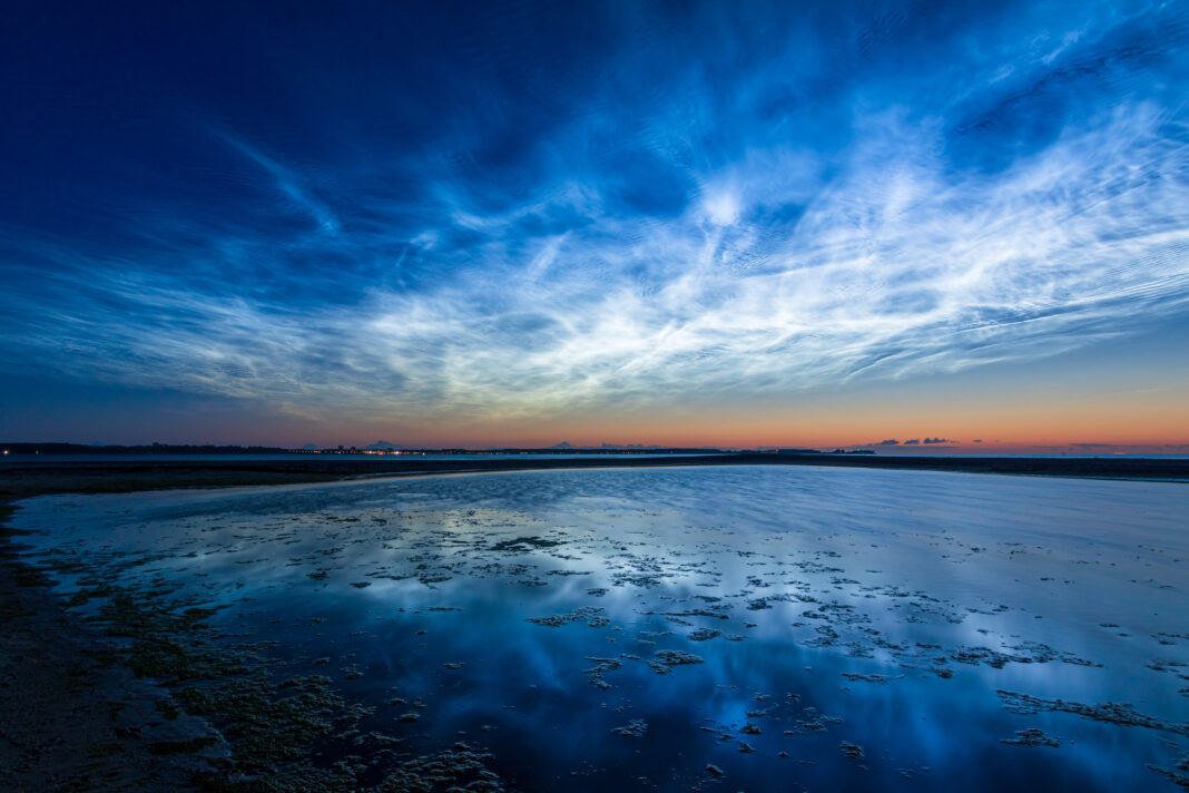
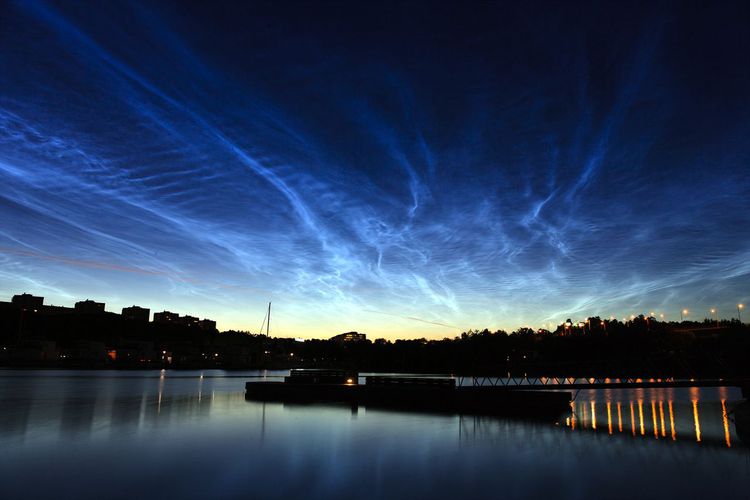
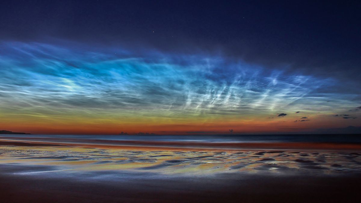
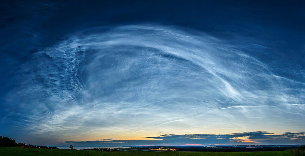
- Shape: Noctilucent clouds form wispy, filament-like structures often arranged in rippled or wave patterns. They can stretch horizontally over hundreds of kilometres.
- Texture: They appear fibrous or finely detailed, with edges illuminated by scattered sunlight during twilight.
- Colour: NLCs are generally bright silvery or bluish-white, and can sometimes show faint iridescent hues under optimal lighting.
- Etymology: The term noctilucent comes from Latin, meaning “night shining”, reflecting their visibility during post-sunset or pre-sunrise twilight when lower clouds are in darkness.
- Precipitation: Noctilucent clouds do not produce precipitation. The ice crystals are extremely small and exist in the very low-pressure, extremely cold mesosphere, where they cannot grow large enough to fall as rain or snow.
Formation and Dynamics
Noctilucent clouds form under very specific mesopheric conditions:
- Extremely low temperatures below −120°C, typical of polar mesospheric summer.
- Presence of water vapour, which is minimal at these altitudes but sufficient to condense onto meteoric dust particles.
- High-latitude summer sunlight, which illuminates the clouds from below the horizon.
Ice crystals in NLCs are typically 10–100 nanometres in diameter, forming from water vapour condensing on meteoric smoke particles. The mesospheric location exposes them to strong winds and gravity waves, which shape their rippling or wave-like patterns.
Historical Context
Noctilucent clouds were first recorded in 1885, shortly after the eruption of Krakatoa, although their regular formation in polar regions was only documented in the early 20th century.
Modern satellite observations, beginning with instruments like AIM (Aeronomy of Ice in the Mesosphere), have allowed detailed study of NLC frequency, distribution, and seasonal variability.
Their observation is limited to high latitudes (50°–70°) during summer months, when the geometry of sunlight relative to the mesosphere allows them to be illuminated against a darker sky.
Observations and Phenomena
- Visibility: NLCs are seen after sunset or before sunrise in twilight conditions. Their high altitude allows them to remain illuminated while the lower atmosphere is in darkness.
- Geographic Occurrence: Predominantly observed in polar and subpolar regions, including Scandinavia, Canada, Alaska, and Antarctica.
- Wave Patterns: Gravity waves in the mesosphere create banded or rippled structures, giving the clouds a distinct textured appearance.
Distinguishing Noctilucent Clouds from Similar Clouds
- Nacreous Clouds: Unlike nacreous clouds, which form in the stratosphere (15–25 km), NLCs form much higher in the mesosphere and only appear during polar summer twilight.
- Cirrus Clouds: Cirrus clouds are tropospheric and lower in altitude, whereas NLCs exist in the upper mesosphere.
- Kelvin-Helmholtz / Fluctus Clouds: These form in the troposphere and display wave-like features due to wind shear, while NLCs are ice crystal clouds illuminated from below.
Further Information
- Scientific Importance: Noctilucent clouds are sensitive indicators of mesospheric temperature and water vapour content, and their occurrence may be influenced by climate change and anthropogenic effects.
- Observation Techniques: Observed visually during twilight, photographed for scientific studies, and tracked by satellites such as AIM and Odin for global monitoring.
- Seasonality: NLCs occur during high-latitude summer months, roughly from May to August in the Northern Hemisphere and November to February in the Southern Hemisphere.
Noctilucent clouds are extremely high-altitude, ice-crystal clouds forming in the mesosphere under very cold, low-pressure conditions.
Their appearance during twilight provides insight into mesospheric dynamics, water vapour content, and atmospheric wave phenomena.
They are a distinct and scientifically valuable feature of polar and subpolar skies, separate from stratospheric or tropospheric cloud types.

