

When you look up at the clouds, it’s never quite the same twice. Sometimes you’ll see wispy streaks high above, other times a blanket of gray, and on stormy days, towering thunderclouds.
Meteorologists group these into families based on how high they form in the atmosphere.
By learning to recognise them, you can start to read the sky like a weather map and even predict what might be coming next.
This classification system helps meteorologists, and cloud lovers, identify and quickly use them to interpret current or upcoming weather conditions.
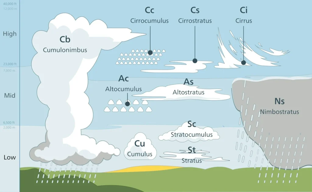
High-Level Clouds (20,000–40,000 ft)
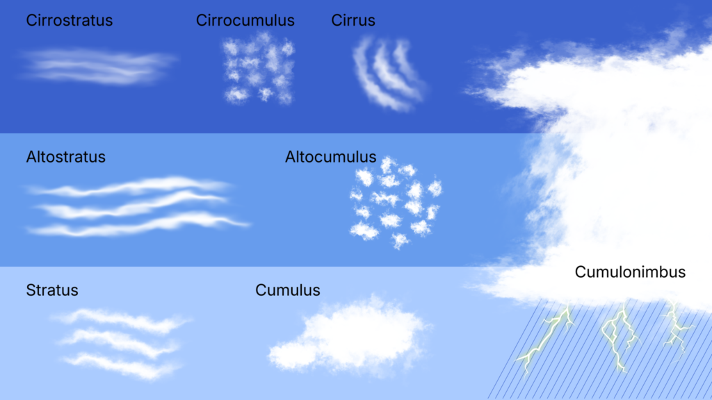
Cirrus (Ci): Wispy, hair-like clouds made entirely of ice crystals. They often signal a change in the weather within a day or two.
Cirrostratus (Cs): Thin and sheet-like, they cover the sky in a veil. They can produce halos around the Sun or Moon.
Cirrocumulus (Cc): Small, rippling patches that look like fish scales — sometimes called a “mackerel sky.”
Mid-Level Clouds (6,500–20,000 ft)
Altostratus (As): Large, gray sheets that dim the Sun. They often thicken into nimbostratus clouds, bringing steady rain or snow.
Altocumulus (Ac): Puffy, cotton-like patches that may appear in groups. Their presence in the morning can sometimes hint at afternoon thunderstorms.
Low-Level Clouds (surface–6,500 ft)
Stratus (St): Flat, gray layers that blanket the sky. They often bring overcast conditions with drizzle or mist.
Stratocumulus (Sc): Lumpy, rolling clouds in a widespread layer. They are usually dry but may produce light drizzle.
Nimbostratus (Ns): Thick, dark clouds that cover the sky and bring prolonged rain or snow.
Vertical-Developing (rising across levels)
Cumulus (Cu): Fluffy, white “fair-weather” clouds shaped like cotton balls. They can grow taller if the atmosphere is unstable.
Cumulonimbus (Cb) Towering thunderstorm clouds with anvil-shaped tops. They produce heavy rain, lightning, hail, and sometimes tornadoes
By recognizing these ten cloud types, we gain insight into how the atmosphere works and how weather develops.
From delicate cirrus clouds high above to powerful cumulonimbus storms stretching through all levels, clouds help us read the sky and prepare for the changes it may bring.
More useful info can be obtained from the UK Met Office

