
Altocumulus clouds are mid-level clouds that typically form between 2,000 and 6,000 metres above the surface. They appear as white or grey patches, sheets, or rolls, often with a textured or rippled appearance.
Altocumulus clouds are an indicator of moderate atmospheric instability and can occur in varied weather conditions, from fair weather to the approach of fronts and storms.
They are distinct from low-level cumulus clouds and high-level cirrus clouds due to their intermediate altitude and layered, often granular structure.

Characteristics of Altocumulus Clouds
Height
Altocumulus clouds usually form at 2,000 to 6,000 metres, placing them in the mid-troposphere. Their vertical thickness is generally modest, typically 500 to 1,500 metres, although they can appear more extensive when associated with larger weather systems.
Appearance
Altocumulus clouds consist of small, rounded cloudlets or patches that may be closely spaced or form larger sheets. They often create a mackerel sky pattern, with repeating textures or undulations across the sky.
The clouds can appear white or light grey, with shading caused by sunlight angles, and sometimes show subtle iridescent colours in thin areas.
Name Meaning
The term altocumulus comes from Latin, meaning “high heap”, reflecting their mid-level altitude and heaped or patchy texture.
Rain
Altocumulus clouds rarely produce precipitation reaching the ground. When thickened or associated with fronts, they may generate light rain or drizzle, but significant precipitation typically requires development into altostratus or cumulonimbus clouds.
Formation and Dynamics of Altocumulus Clouds
Altocumulus clouds form through moderate convection in the mid-troposphere, often where moist air rises over cooler air layers.
They can also develop through the spreading of rising cumulus clouds or the lifting of stratified layers by fronts. Atmospheric stability, humidity, and vertical wind shear influence their shape, spacing, and texture.
These clouds are frequently seen ahead of warm fronts and may indicate approaching precipitation when forming extensive layers.
Their presence provides meteorologists with information about mid-level moisture content and atmospheric dynamics.
Altocumulus are made up of lots of little rounded clumps or rolls, sometimes looking like a “field” of cotton balls spread across the sky. They’re larger and darker than cirrocumulus, but smaller than low-level stratocumulus.
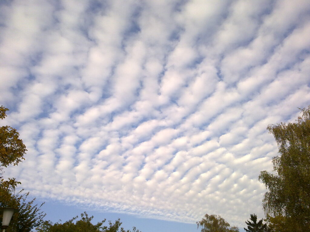
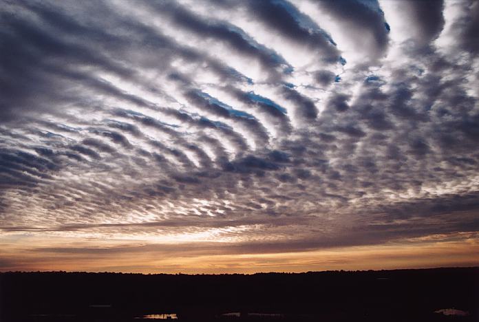
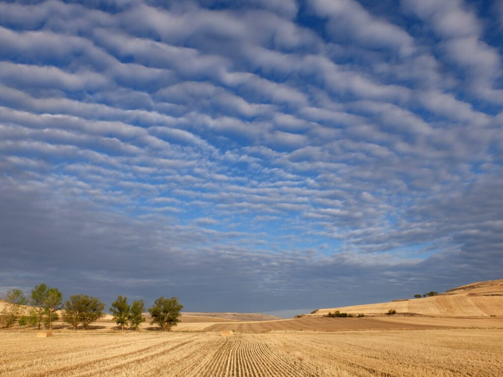
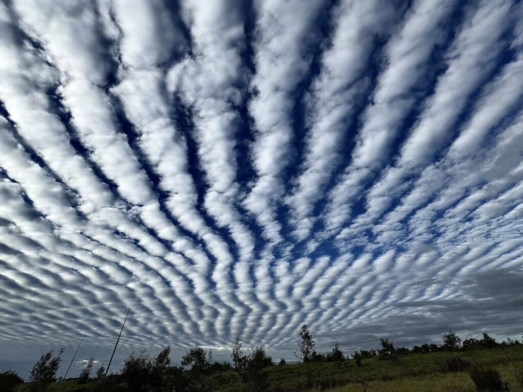
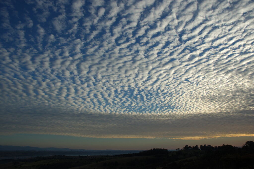
Altocumulus Undulatus Clouds
Altocumulus undulatus clouds are a variant of altocumulus clouds characterised by wave-like, undulating patterns across the sky. They typically form in the mid-troposphere, between 2,000 and 6,000 metres, and appear as parallel bands or ripples of cloudlets.
The undulations are the result of wind shear or gravity waves in the atmosphere, which create alternating areas of rising and sinking air that shape the cloud layer into a regular, patterned structure.
These clouds usually consist of small, rounded cloudlets similar to standard altocumulus, but the defining feature is the linear or wavy alignment. They often stretch for many kilometres across the sky, producing a mackerel sky effect.
The colour is generally white to light grey, with shading that highlights the wave pattern and sometimes subtle iridescence in thin sections.
Altocumulus undulatus clouds form in stable, stratified layers of moist air when moderate winds at different altitudes generate vertical oscillations.
Watching these clouds can provide information about mid-level atmospheric stability and wind direction aloft.
They are commonly seen ahead of frontal systems or in regions where airflow over terrain or temperature inversions produces regular wave patterns.
Although these clouds rarely produce precipitation that reaches the ground, their formation is an indicator of atmospheric dynamics and can sometimes precede storm development if conditions support additional convection.
Their structured appearance makes them an important visual tool for meteorologists and weather observers studying mid-level cloud patterns and atmospheric motion.
Historical Context
Altocumulus clouds were formally classified in the 19th century as part of the tropospheric cloud taxonomy.
Their distinctive textures and mid-level position were recognized as indicators of atmospheric conditions, and they remain a key cloud type in weather observation and forecasting.
As with other cloud genera, the name traces back to Howard’s system extended by later classifications.
The 1896 Cloud Atlas and subsequent editions solidified usage. In literature, “altocumulus” as a name is seldom seen before modern meteorology; but mid-level cloud banks appear in Romantic and pastoral writing.
Observations and Phenomena
Altocumulus clouds display a variety of patterns, including parallel bands, waves, or patches, often influenced by gravity waves or wind shear.
Observing their texture and extent can provide insights into mid-level atmospheric stability. They are commonly seen on warm, humid mornings and may precede thunderstorms if conditions support further vertical development.
Distinguishing Altocumulus Clouds from Similar Clouds
Altocumulus clouds differ from cumulus clouds, which form at lower altitudes and exhibit stronger vertical development.
They are also distinct from cirrocumulus clouds, which are smaller, higher, and composed entirely of ice crystals.
Altostratus clouds are generally featureless layers, whereas altocumulus clouds display distinct texture or cloudlets.
Further Information
Altocumulus clouds contribute to the Earth’s radiation balance by reflecting sunlight and influencing mid-level convection.
They are frequently used in weather forecasting as indicators of moisture content, atmospheric instability, and potential storm development.
Their patterned appearance also aids in identifying gravity wave activity in the mid-troposphere.
Altocumulus clouds are a common mid-level cloud type that combines distinct texture, moderate altitude, and variable weather associations.
Observing their formation, structure, and evolution provides information about atmospheric stability, moisture, and potential precipitation, making them a significant feature in meteorology and weather forecasting.

