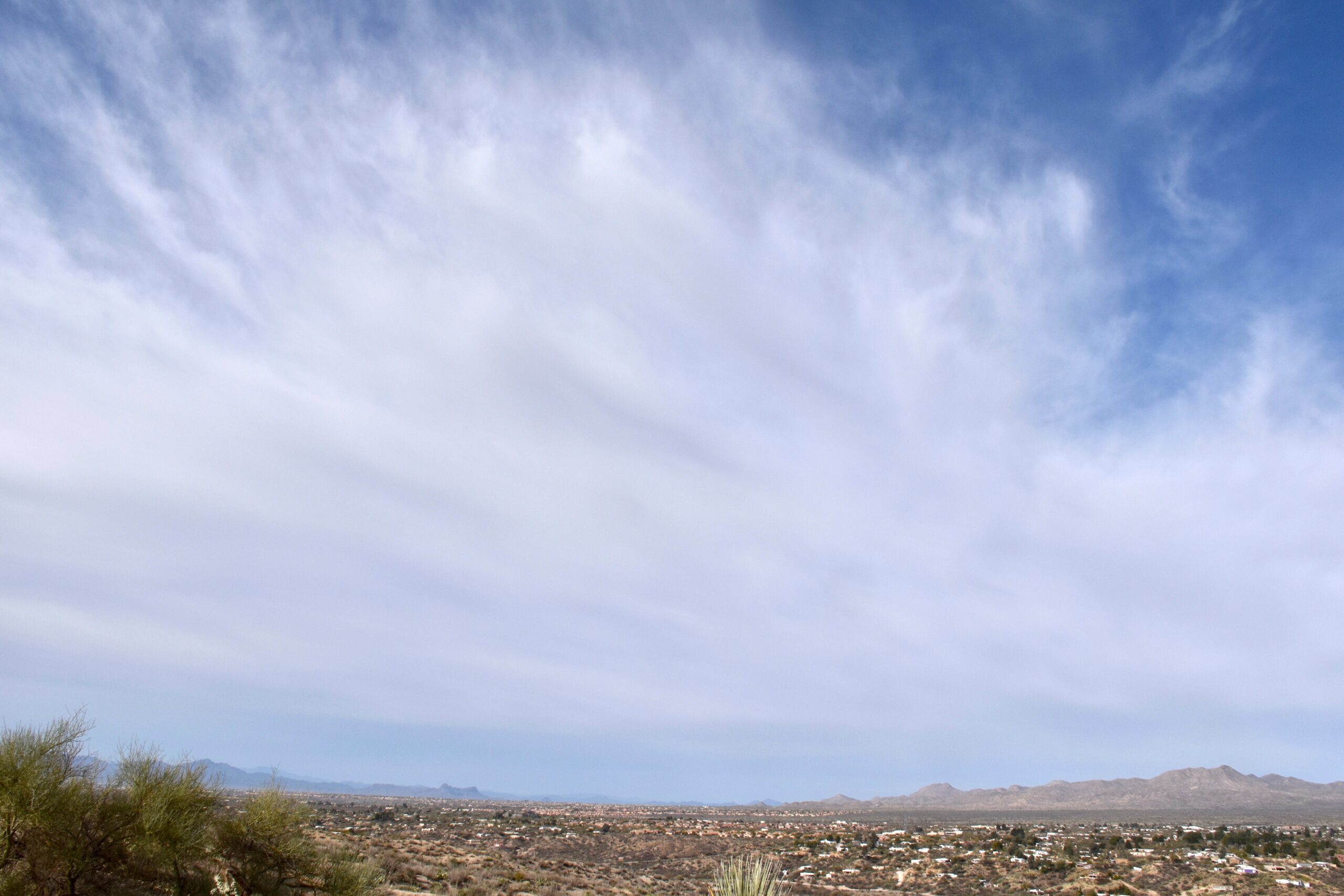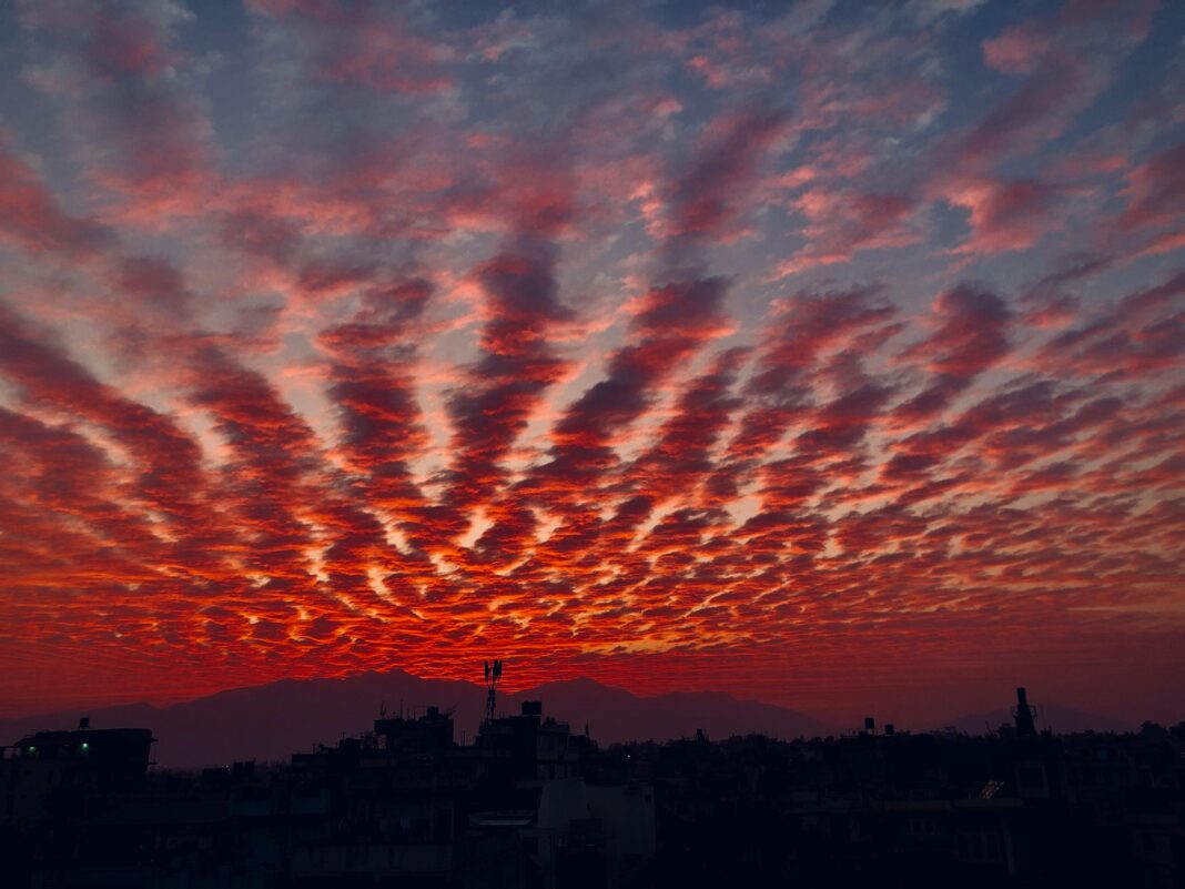

Cirrocumulus clouds are high-level clouds that appear as small, white patches or ripples, often covering portions of the upper sky in a delicate, patterned layer.
They form at altitudes of approximately 6,000 to 12,000 metres, in the upper troposphere, where temperatures are well below freezing.
Cirrocumulus clouds are composed primarily of ice crystals, though some may contain supercooled water droplets.
They are typically thin and short-lived, forming under stable atmospheric conditions and influenced by high-level wind shear or gravity waves.

Detailed Characteristics
Height
Cirrocumulus clouds form at altitudes between 6,000 and 12,000 metres (20,000–40,000 feet). Their vertical thickness is relatively shallow, often less than 500 metres, giving them a sheet-like or patchy appearance.
They occupy the same high-altitude zone as cirrus and cirrostratus clouds but can be distinguished by their rippled or cellular structure.
Appearance
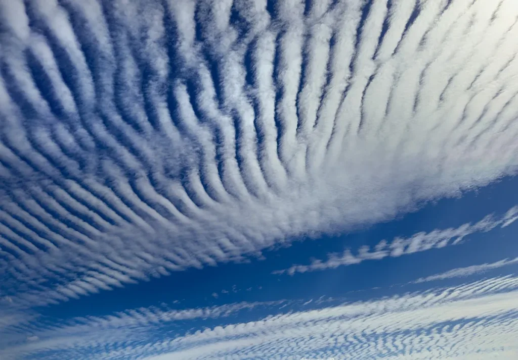
Cirrocumulus clouds consist of small, regularly arranged cloudlets that appear as grains, ripples, or wave-like rows. The individual elements are typically less than 1° in apparent width, smaller than a little finger held at arm’s length.
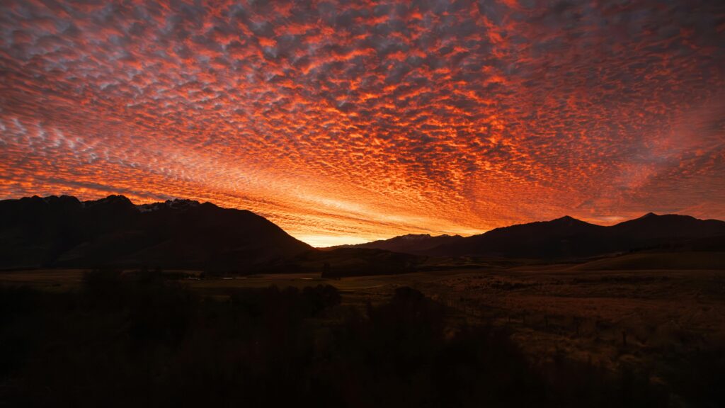
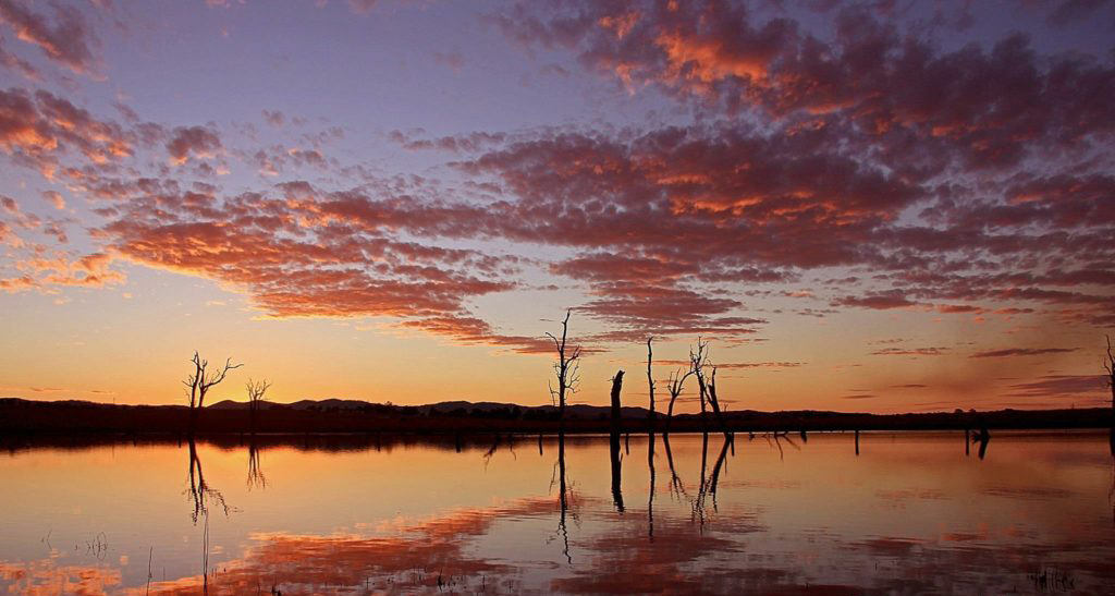
They often produce a mackerel sky, a term describing their resemblance to fish scales. Cirrocumulus clouds are usually white and bright, rarely casting shadows, and do not display the fibrous appearance typical of cirrus clouds.
Cirrocumulus clouds appear as lots of tiny, white patches grouped together in patterns. They’re smaller and finer than altocumulus, and since they’re made of ice crystals, they don’t cast much of a shadow.
On some days, they cover large sections of the sky, giving it a rippled, almost scaly look. This “mackerel sky” is one of their most recognizable features.
Name Meaning
The term cirrocumulus derives from the Latin words cirrus, meaning “curl,” and cumulus, meaning “heap.” This reflects their combination of cirrus-like altitude with a cumulus-like structure.
Rain
Cirrocumulus clouds do not produce precipitation that reaches the surface. Any ice crystals or droplets falling from them will sublimate or evaporate long before reaching lower atmospheric levels.
However, their presence can precede the development of altocumulus or cirrostratus layers as weather systems evolve.
Formation and Dynamics
Cirrocumulus clouds form through small-scale convection or wave motions within the high troposphere. When moist air is lifted and cooled near the tropopause, ice crystals condense or deposit, creating thin layers of cloudlets.
The regular pattern of these clouds is often caused by gravity waves or wind shear, which organise the ice crystals into evenly spaced ripples.
They may also develop from the transformation of cirrus or cirrostratus clouds when the upper atmosphere becomes slightly more unstable, allowing weak vertical motions.
Conversely, cirrocumulus clouds can dissipate back into cirrostratus layers as conditions stabilise.
Their formation frequently occurs ahead of approaching warm fronts or jet stream disturbances, indicating moisture and instability at high levels of the atmosphere.
Historical Context
Cirrocumulus clouds were included in the early scientific classifications of clouds in the 19th century. They were described by Luke Howard and later refined within the International Cloud Atlas published by the World Meteorological Organization (WMO).
Their identification has long been used by forecasters as a signal of changing upper-level atmospheric conditions, particularly the approach of frontal systems or jet stream shifts.
Again, Luke Howard’s naming tradition underpins cirrocumulus (though Howard himself did not distinctly separate all high genera). The 1896 International Cloud Atlas formalised many names.
As for early cultural mentions, the pattern “mackerel sky” appears in old sailors’ sayings (“Mackerel sky, mackerel sky; never long wet, never long dry”) i.e. in folk weather rhymes.
Observations and Phenomena
Cirrocumulus clouds are short-lived and dynamic, often changing form within minutes as high-level winds deform or disperse them. They frequently coexist with other high clouds such as cirrus fibratus or cirrostratus nebulosus, and transitions between these types can occur.
The presence of cirrocumulus clouds may produce subtle optical effects, including iridescence or coronas, due to the diffraction of sunlight through uniformly sized ice crystals.
The patterns seen in cirrocumulus clouds often reflect gravity wave motion in the upper troposphere, providing visible evidence of atmospheric wave energy and turbulence at those levels.
Distinguishing Cirrocumulus from Similar Clouds
Cirrocumulus clouds differ from altocumulus clouds by their smaller, finer texture and higher altitude. In general, if the individual cloudlets are smaller than the width of a finger at arm’s length, they are cirrocumulus.
If the patches are larger, they are altocumulus. Cirrocumulus also differ from cirrostratus clouds, which form thin, featureless veils that cover large portions of the sky and often produce halos.
Further Information
Cirrocumulus clouds play a subtle but important role in the Earth’s radiation balance, reflecting incoming solar radiation while allowing much of the infrared radiation to escape.
Their presence marks moisture intrusions into the upper troposphere, often linked to large-scale weather systems or tropical convection outflow.
They are also significant for research into high-level atmospheric dynamics, aerosol interactions, and ice-crystal microphysics.
Observations of cirrocumulus clouds, especially by satellite, provide insight into tropopause humidity, gravity wave propagation, and jet stream activity.
Cirrocumulus clouds are delicate, high-level formations that reveal the intricate dynamics of the upper troposphere. Their fine, patterned structures form through gentle wave motions and moisture variations in the upper atmosphere.
Though they rarely produce precipitation, their presence can indicate increasing upper-level moisture and instability, serving as a useful signal of approaching weather changes.