
A Scientific Exploration of the formation of Clouds
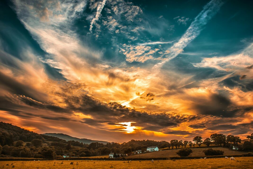
Clouds are one of the most visible and dynamic components of Earth’s atmosphere.
They influence weather, climate, and even human activities, while providing a spectacular canvas in the sky.
Understanding cloud formation requires examining the physical processes that transform invisible water vapour into visible condensed droplets or ice crystals.
I’ll attempt to explore the science behind cloud formation, the different cloud types, and the conditions under which they form.
The Basics of Cloud Formation
Clouds are formed when moist air rises and cools, causing the water vapour it contains to condense into tiny water droplets or ice crystals.
This process begins with saturation, which occurs when air reaches 100 per cent relative humidity, meaning it cannot hold any more water vapour. Cooling can occur via several mechanisms:
- Adiabatic cooling occurs when air expands as it rises through lower atmospheric pressure. Rising air cools at a predictable rate: the dry adiabatic lapse rate of approximately 9.8°C per kilometre for unsaturated air, and the moist adiabatic lapse rate of 5–7°C per kilometre for saturated air.
- Radiative cooling occurs when the Earth’s surface loses heat overnight, chilling the air above it.
- Orographic lifting occurs when air is forced to rise over mountains, cooling as it ascends.
Once air reaches its dew point, condensation begins, forming cloud droplets. This process is facilitated by cloud condensation nuclei (CCN), tiny particles such as dust, sea salt, or pollen, which provide surfaces for water vapour to condense upon.
Without CCN, condensation requires a much higher level of supersaturation.
Cloud Microphysics
Cloud droplets are extremely small, typically 10 micrometres in diameter, and weigh only a few millionths of a gram.
Ice crystals, which form in colder clouds, can vary from 50 micrometres to several millimetres. Two key processes dominate droplet growth in clouds:
- Collision-coalescence: In warm clouds (above 0°C), larger droplets fall faster, colliding and merging with smaller droplets to form raindrops.
- Bergeron–Findeisen process: In mixed-phase clouds, where both supercooled water droplets and ice crystals coexist, ice crystals grow at the expense of liquid droplets due to differences in saturation vapour pressure. This mechanism is the primary source of snow and ice precipitation in mid-latitude clouds.
Clouds are highly dynamic systems, constantly evolving as droplets form, collide, freeze, evaporate, and fall.
Atmospheric turbulence also contributes to the vertical and horizontal mixing of air, shaping the structure of clouds.
The Bergeron–Findeisen Process
The Bergeron–Findeisen process describes how ice crystals grow within cold clouds at the expense of nearby supercooled water droplets.
It is the main mechanism behind precipitation in mixed-phase clouds, which contain both liquid and solid particles.
When temperatures fall below 0°C, tiny ice crystals form alongside liquid droplets that remain unfrozen due to the absence of freezing nuclei.
Because the saturation vapour pressure over ice is lower than over liquid water, water vapour naturally migrates from the supercooled droplets towards the ice crystals.
This causes the ice crystals to grow while the droplets evaporate.
This process is crucial in developing precipitation from cold and mid-level clouds such as nimbostratus and altostratus.
As ice crystals increase in size, they eventually become heavy enough to fall through the cloud. During their descent, they may collide with other crystals, merge, or melt into raindrops when entering warmer air layers.
The Bergeron–Findeisen process therefore explains how snowflakes and rain often originate from the same mixed-phase cloud.
It also underpins many weather modification techniques, such as cloud seeding, which aim to enhance rainfall by introducing artificial ice nuclei to stimulate this natural growth mechanism.
Classification of Clouds
Clouds are classified by altitude and appearance. The World Meteorological Organization recognises ten main cloud types, divided into four altitude levels:
High-Level Clouds (Above 6,000 metres)

- Cirrus (Ci): Thin, wispy clouds composed of ice crystals. They form in stable, dry conditions and often indicate fair weather, though they can precede warm fronts.
- Cirrostratus (Cs): Transparent, sheet-like clouds that often cover the sky and create halo effects around the Sun or Moon.
- Cirrocumulus (Cc): Small, white patches resembling fish scales, sometimes called a “mackerel sky.”
Mid-Level Clouds (2,000–6,000 metres)

- Altostratus (As): Grey or blue-grey sheets covering the sky, often preceding continuous rain.
- Altocumulus (Ac): Puffy or rippled mid-level clouds, which can indicate instability if appearing in the morning.
Low-Level Clouds (Up to 2,000 metres)
- Stratus (St): Grey, uniform layers covering the sky, producing light drizzle or mist.
- Stratocumulus (Sc): Low, lumpy clouds with gaps of clear sky, often forming in stable conditions.
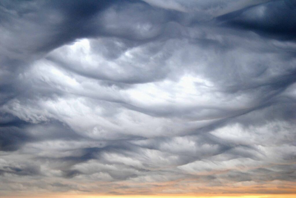
- Nimbostratus (Ns): Thick, dark clouds producing steady, prolonged precipitation.
Clouds with Vertical Development
- Cumulus (Cu): Fluffy, cotton-like clouds with flat bases, forming in rising thermals.
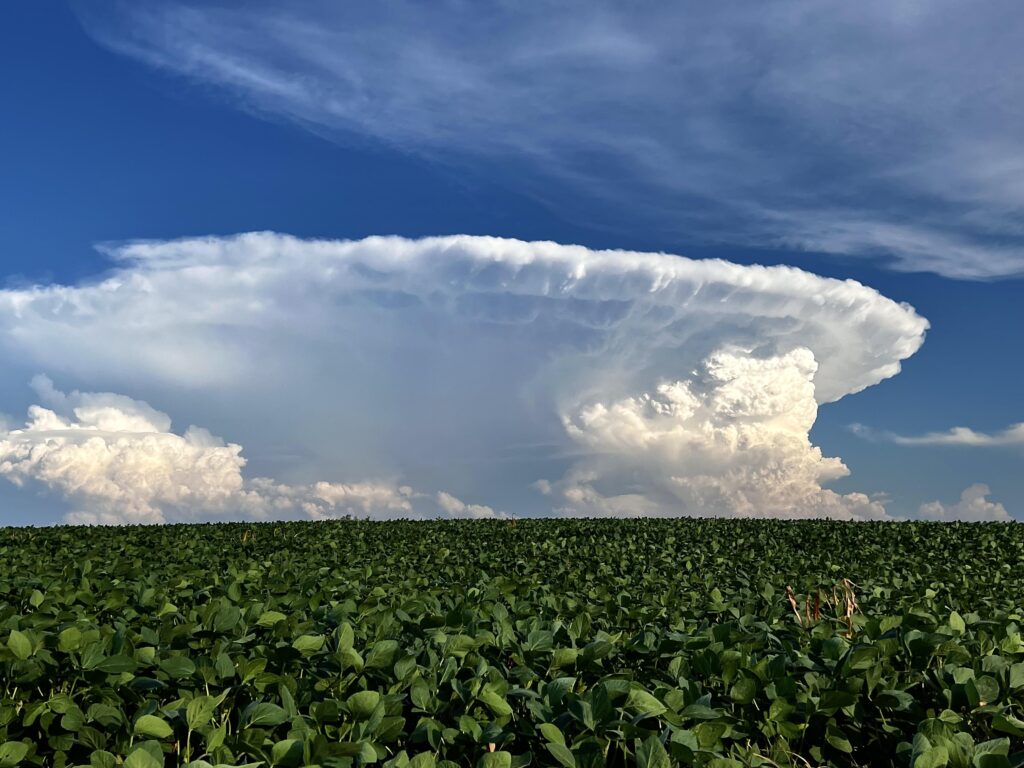
- Cumulonimbus (Cb): Towering thunderstorm clouds with extensive vertical development, capable of producing heavy rain, hail, and lightning.
Formation Mechanisms
Clouds can form through several atmospheric mechanisms:
Convection
Rising warm air due to surface heating causes cumulus clouds to form. Convection is strongest in the tropics, producing towering cumulonimbus clouds and thunderstorms.
Convection also drives the turbulent mixing that shapes smaller clouds like cumulus fractus.
Orographic Lifting
Air forced over mountains cools and condenses to form clouds. Common orographic clouds include lenticular clouds, which have smooth, lens-like shapes, and orographic cumulus.
These clouds often remain stationary relative to the terrain.
Frontal Lifting
Clouds form along weather fronts where warm air is forced over cold, dense air. Warm fronts typically produce widespread altostratus or nimbostratus clouds, while cold fronts generate cumulus and cumulonimbus clouds along a narrow boundary.
Convergence
When winds meet at the surface and are forced upward, clouds form. This is common in low-pressure systems and along coastlines, where sea breezes converge with continental air.
Special Cloud Types
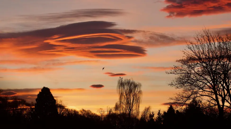
Lenticular Clouds
Lenticular clouds form over mountains due to standing waves in the atmosphere. They have smooth, lens-like shapes and can appear stacked like pancakes. Unlike convective clouds, they are stationary relative to the terrain, and their formation indicates strong, stable wind flow aloft.
Mammatus Clouds
Mammatus clouds are pouch-like formations that hang underneath large thunderstorm clouds. They look dramatic, with bulging, rounded shapes that resemble a cluster of bubbles.
While they may appear threatening, they do not produce severe weather themselves. Instead, they often signal that a storm system is nearby or dissipating.
Fractus Clouds
Fractus clouds are small, ragged fragments that appear under or at the edges of larger cloud bases.
They are divided into cumulus fractus, which are taller, lighter, and indicate rising air, and stratus fractus, which are flatter, darker, and suggest stable, moist conditions.
These clouds form quickly and dissipate just as fast, shaped by turbulent air currents and shifting moisture levels.
Roll Clouds
Roll clouds are long, cylindrical clouds that appear to roll along a horizontal axis.
They typically form along outflow boundaries of thunderstorms or cold fronts when cool air undercuts warmer moist air, causing it to lift and condense.
Horizontal rotation within the cloud creates the striking rolling appearance, with air rising at the front and descending at the rear.
The famous Morning Glory cloud in northern Australia is a dramatic example.
Shelf Clouds
Shelf clouds develop at the leading edge of thunderstorms. They form when cool downdrafts from the storm lift the warmer air ahead, causing condensation along the outflow boundary.
Their wedge-like shape and ragged lower edge are caused by turbulence at the interface between the descending and ascending air, often signalling the approach of strong winds and rain.
Pileus clouds
Pileus clouds form as thin, smooth caps on top of growing cumulus towers. They appear when strong updrafts push moist air quickly upward, cooling it into a veil-like layer.
Pileus clouds are short-lived, often vanishing as the cumulus cloud below continues to grow into a thunderstorm.
Fallstreak or Hole-punch clouds
Fallstreak or hole-punch clouds are large circular gaps in altocumulus or cirrocumulus layers.
They form when aircraft pass through supercooled cloud, triggering ice crystal formation. As droplets freeze, surrounding water evaporates, leaving a clear hole with icy streaks falling beneath.
They are striking but relatively rare atmospheric phenomena.
Cloud Life Cycle
Clouds do not last indefinitely. Their life cycle depends on the balance between condensation, evaporation, and precipitation:
- Formation: Moist air rises and cools to its dew point, forming droplets or ice crystals.
- Maturity: Droplets grow through collision-coalescence or the Bergeron–Findeisen process. The cloud becomes visible and may produce precipitation.
- Dissipation: If air becomes drier or rising motion ceases, droplets evaporate, and the cloud disappears.
Small cumulus clouds can form and dissipate within minutes, while nimbostratus clouds can persist for several hours.
Cumulonimbus clouds evolve quickly but can produce intense storms before collapsing.
Cloud Observations and Weather Prediction
Clouds provide important clues for meteorologists:
- High, thin cirrus clouds often indicate an approaching warm front.
- Altocumulus in the morning can suggest instability and the potential for afternoon thunderstorms.
- Cumulonimbus clouds signal severe weather, including thunderstorms, hail, and tornadoes.
Cloud observations, combined with temperature, pressure, and wind data, help meteorologists anticipate precipitation, storm development, and changing weather patterns.
Clouds and Climate
Beyond weather, clouds play a critical role in regulating Earth’s climate. They reflect sunlight, cooling the surface, and trap infrared radiation, warming the atmosphere.
Different cloud types have varying effects:
- High cirrus clouds allow sunlight to pass through but trap outgoing infrared radiation, exerting a net warming effect.
- Low stratus clouds reflect sunlight effectively, exerting a net cooling effect.
Understanding cloud formation, types, and behaviour is therefore essential not only for weather forecasting but also for climate modelling.
Technological Advances in Cloud Study
Modern meteorology relies on satellite imagery, radar, and lidar to study clouds. Satellites provide global cloud coverage and track large-scale systems like hurricanes and monsoons.
Radar detects precipitation within clouds, while lidar measures cloud base height and density.
High-altitude research aircraft sample cloud microphysics directly, allowing scientists to measure droplet size, ice crystal formation, and cloud dynamics in real-time.
Conclusion
Clouds are dynamic, complex phenomena shaped by atmospheric conditions, moisture, and thermodynamics.
From the delicate cirrus high in the troposphere to towering cumulonimbus thunderstorms, cloud formation reflects the intricate balance of rising air, condensation, and evaporation.
Understanding clouds is vital for weather prediction, climate research, and appreciating the ever-changing sky above.
By studying cloud types, formation mechanisms, and microphysical processes such as the Bergeron–Findeisen and collision-coalescence processes, scientists can unravel the mysteries of one of nature’s most visible and influential systems.

