Cirrus Clouds

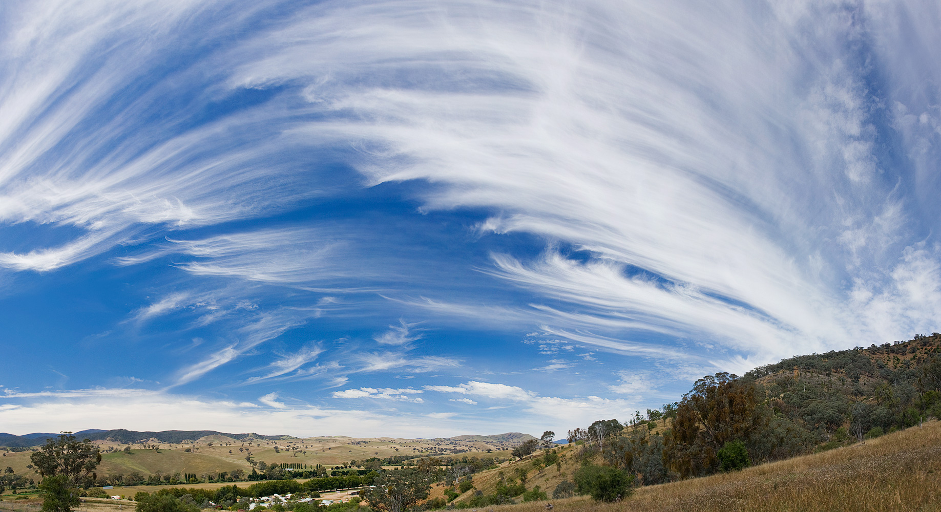
Cirrus clouds are high-altitude, thin, wispy clouds composed almost entirely of ice crystals. They often appear as streaks or filaments, sometimes looking like horse tails in the sky.

Because they are composed of ice, they are generally semi-transparent and delicate in appearance.
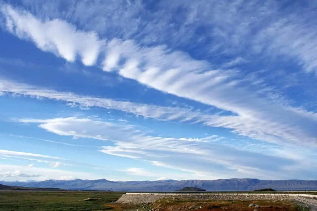
Cirrus clouds, El Calafate, Argentina

Characteristics of Cirrus Clouds

  • Base Altitude: Cirrus clouds form at high altitudes, typically between 6,000 and 13,000 metres (20,000–43,000 feet), within the upper troposphere.
  • Top Altitude: Their vertical extent is generally limited to a few hundred metres, although in some cases the clouds can stretch higher within strong convective or jet stream-influenced regions.
  • Shape: Cirrus clouds are thin, wispy, and filamentous, often appearing as streaks, hooks, or curls across the sky. They frequently form long, linear bands aligned with upper-level winds.
  • Texture: They have a delicate, feathery texture composed of ice crystals, giving them a translucent appearance.
  • Colour: Cirrus clouds are usually white or very pale grey, brightened by sunlight; they rarely exhibit any significant coloration except at sunrise or sunset.
  • Etymology: The word cirrus comes from Latin, meaning “curl” or “fringe”, describing the cloud’s fine, hair-like strands.
  • Precipitation: Cirrus clouds do not produce surface precipitation. The ice crystals may fall as virga, evaporating or sublimating before reaching the ground due to the dry air below.

What do cirrus clouds look like?

Cirrus clouds are thin, silky, and often look like tufts or streaks of hair spread across the sky. In the daytime, they’re the brightest white clouds you’ll see.

At sunrise or sunset, they can turn vivid shades of red, orange, or pink, catching the colours of the sun.
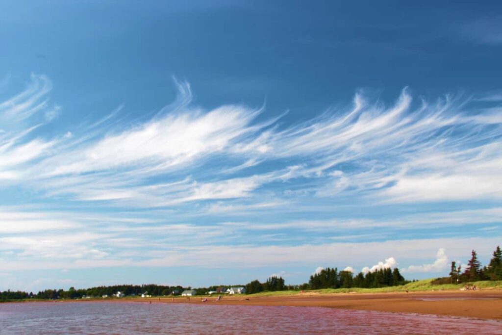
Cirrus heralds a warm front – and rain

How do they form?

Cirrus forms when dry air rises and the little bit of water vapour in it freezes straight into ice crystals. Because they’re made entirely of ice, they look so white and wispy.

Just like cirrostratus, cirrus can also form from plane contrails. Those long jet trails in the upper atmosphere can spread out and turn into cirrus, cirrostratus, or cirrocumulus.

What kind of weather do they mean?

Cirrus usually shows up before a warm front moves in. When you see them streaking across the sky, it often means the weather is going to shift; rain or snow could be on the way within a day or so.

They technically do produce precipitation, but it evaporates before reaching the ground. That creates something called virga; streaks that hang below the cloud and fade away mid-air.
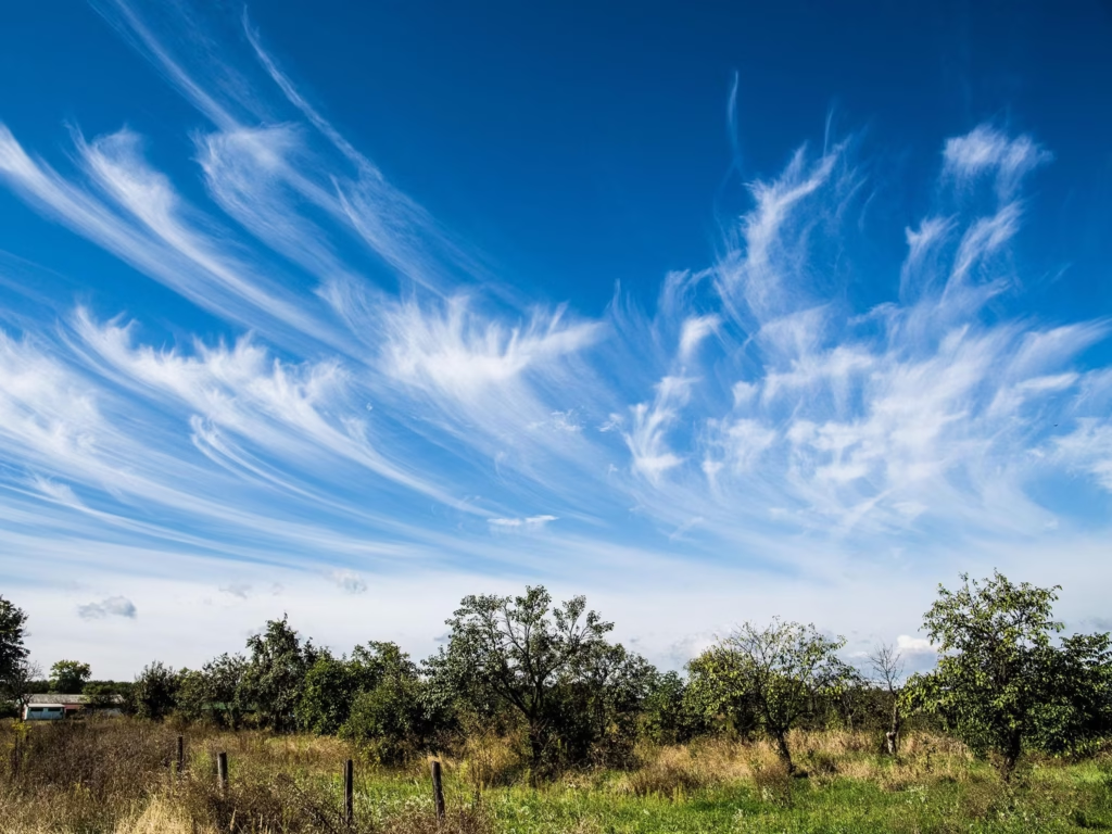
Cirrus uncinus, or “mare’s tails”

Types of Cirrus clouds

There are a few different “species” of cirrus, each with its own look:

Cirrus castellanus
Taller than they are wide, with little turret-like tops rising upward.

Cirrus fibratus
Thin, fibrous strands lined up with the wind, often forming white streaks across the sky. The most common type.

Cirrus uncinus
The classic “horse’s tail” cloud, with a little hook or flick at the end of each strand.

Cirrus spissatus
Thick and dense, often covering a lot of the sky. These usually form from passing warm fronts or the leftovers of big storm clouds.

Cirrus floccus
Ragged, cotton-wool-like patches, larger than cirrocumulus floccus.
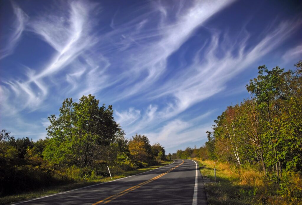
Cirrus Cluds. Wispy streaks of ice crystals

The history of Cirrus clouds

In terms of formal scientific classification, Luke Howard’s scheme of 1802 gave the name cirrus (Latin for “curl” or “fringe”) and he is credited with naming the principal cloud forms (cirrus, cumulus, stratus).

The first appearance of the term in meteorological literature is in Howard’s works in the early 19th century.
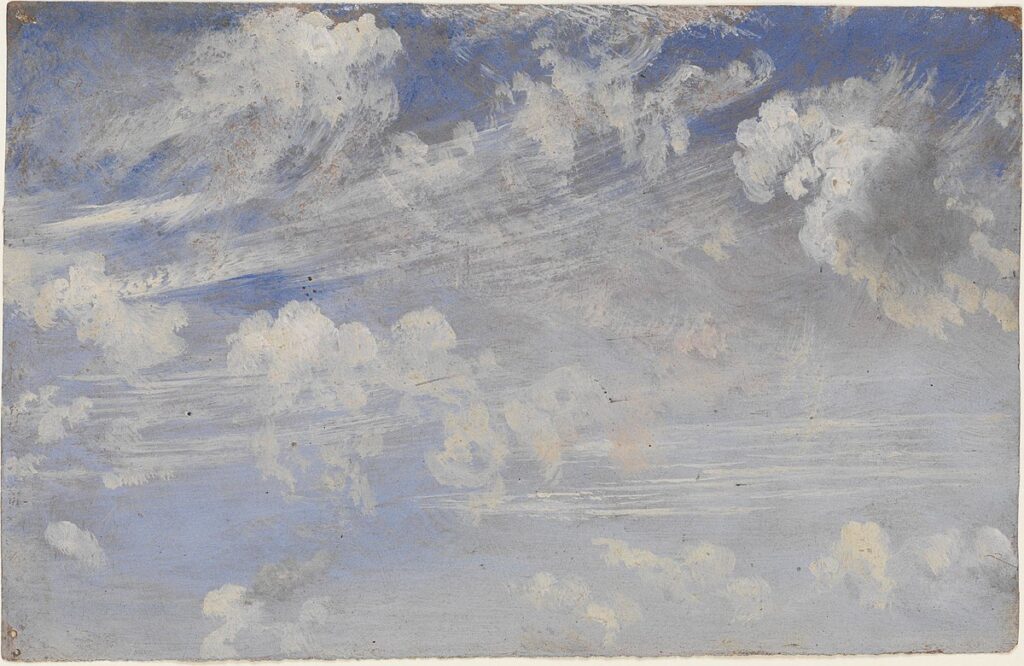
"Study of Cirrus Clouds" by English artist John Constable
“Study of Cirrus Clouds” by English artist John Constable

As for colloquial or artistic mention, cirrus clouds have long been painted (for instance in Romantic landscape art) and discussed in poetry.

An 1822 painting named “Study of Cirrus Clouds” by English artist John Constable hangs in the Victoria and Albert Museum in London.

Tony S.
Tony is based in Australia and focuses on how false conspiracy theories spread and harm society, with an emphasis on clear facts and critical thinking.

Related

Altocumulus Clouds

Altocumulus are mid-level, patchy, somewhat convective clouds forming in moist layers with slight instability. They often show patterns or grouping. Their name originated in the 19th-century expansion of cloud classification, though clouds of this sort were long observed in art and literature.

Atmospheric Gravity Waves

Atmospheric gravity waves are like the ripples that spread across a pond after a stone is dropped, except they move through air instead of water. When air is pushed upward by mountains, storms, or weather fronts into a stable layer of the atmosphere, gravity pulls it back down.

Volutus Clouds

Volutus clouds, commonly known as roll clouds, are a type of Arcus Cloud. They are rare, low-level cloud formations characterized by their distinctive tube-like shape and horizontal orientation. They typically appear detached from other cloud systems and exhibit a rolling motion along a horizontal axis.

10 Main Cloud Types

he ten major cloud types are divided into high-level, mid-level, low-level, and clouds with vertical development, reflecting their formation altitude and structure. Each type exhibits distinctive physical and visual characteristics and provides insight into the atmospheric processes at work.

The chemtrail conspiracy would collapse within a few years

Physicist David Grimes’s 2016 mathematical model shows that large conspiracies such as Chemtrails inevitably unravel through leaks. His analysis demonstrates that a secret global spraying programme involving thousands of people over decades is statistically implausible.

Cumulonimbus Clouds

Cumulonimbus are massive, convective, rain-producing clouds with substantial vertical extent and storm potential. They form in unstable, moist conditions and were formalised in cloud atlases; they appear frequently in art and storm literature.

Featured

Counting the Cost of a Nationwide Chemtrail Programme

What would it actually take to run a nationwide US “chemtrail” operation? Our analysis reveals the staggering logistics — 165 aircraft, thousands of workers, and billions of dollars each year. The numbers tell their own story.

Why Contrails Can Linger and Spread

Contrails can linger and spread because they are essentially man-made cirrus clouds formed from ice crystals at high altitude. A cloud is made of water vapour, just like a contrail. Therefore if a cloud can linger, so can a contrail. When an aircraft’s hot exhaust mixes with cold, humid air, the resulting condensation freezes, creating thin white trails.

The Logistics of Secrecy: The Impossible Scale of a Chemtrail Programme

This article examines the chemtrail conspiracy through physics, engineering, and economics. It shows that a nationwide spraying programme would require hundreds of aircraft, thousands of staff, and billions in funding—leaving clear evidence. The science of contrails fully explains the phenomenon without invoking any secret aerosol operation.

The chemtrail conspiracy would collapse within a few years

Physicist David Grimes’s 2016 mathematical model shows that large conspiracies such as Chemtrails inevitably unravel through leaks. His analysis demonstrates that a secret global spraying programme involving thousands of people over decades is statistically implausible.

Cloud Seeding: You can’t Just Make Rain

It is impossible to manufacture rain, which depends on water vapour in the atmosphere. This is supplied by heat and evaporation from the Earth’s surface. Only when moist air cools and condenses into clouds is there potential for rain. Techniques such as cloud seeding cannot create this water; they can only encourage raindrops to form in clouds that are already primed to produce rain.

Cloud Seeding is Not Chemtrails

Cloud seeding and so-called “chemtrails” are fundamentally different, though often confused in conspiracy circles. Cloud seeding is a small-scale, scientifically documented technique in which aircraft introduce minute amounts of silver iodide into existing clouds to encourage rainfall; it does not involve spraying chemicals into clear skies, nor does it leave visible white streaks. Chemtrails.

Popular Categories