Stratus Clouds

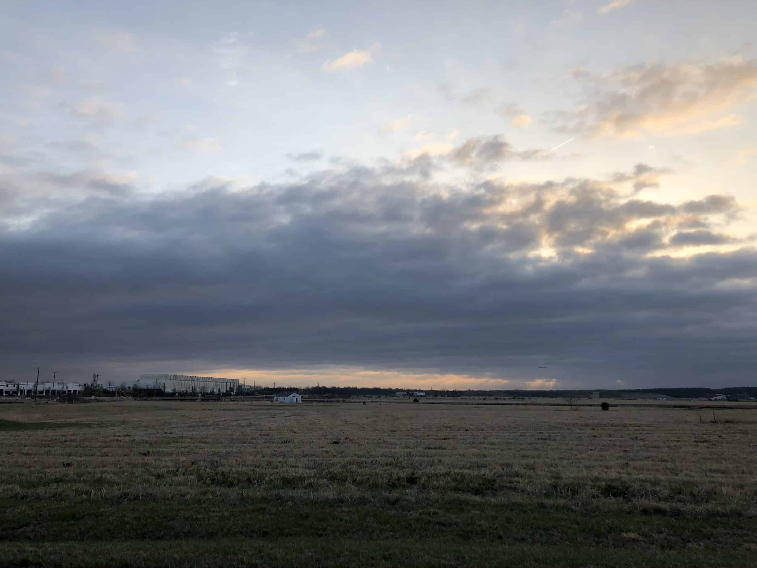
Stratus clouds are the low, gray layers that often blanket the sky like a dull sheet. They sit close to the ground and usually make the sky look overcast.

  • Height: Ground level to ~6,500 ft
  • Look: Flat, featureless layers
  • Name meaning: Stratus = spread out
  • Rain: Light drizzle or mist at times

What do stratus clouds look like?

Stratus clouds cover the whole sky in a uniform gray layer, sometimes making it hard to tell where the horizon ends and the clouds begin.

Stratus can make the day feel gloomy and dim, and sometimes they even touch the ground. When that happens, we call it fog.

Stratus Clouds

How do they form?

Stratus clouds usually form when moist air near the ground is gently lifted or cooled, often by light winds or a temperature inversion. They’re especially common in coastal areas or valleys in the morning.

What weather do they bring?

Stratus clouds don’t usually produce heavy rain, but they can bring drizzle, mist, or light snow. They’re more about dull skies than big storms.

A history of Stratus clouds

The standard name is stratus (St). Varieties include stratus nebulosus, stratus fractus, etc.

The term “stratus” comes from Latin meaning “spread out” or “layer.” Howard’s scheme adopted it, and later cloud atlases refined it.

Tony S.
Tony is based in Australia and focuses on how false conspiracy theories spread and harm society, with an emphasis on clear facts and critical thinking.

Related

Mammatus Clouds

Mammatus clouds are pouch-like protrusions hanging beneath the anvil of cumulonimbus clouds or, more rarely, other cloud types. They mark areas of intense downdraft and are striking indicators of turbulent atmospheric processes.

Are They Finally Admitting It?

Despite frequent claims, there is no credible evidence that large-scale geoengineering programs or “chemtrails”, are secretly operating. In contrast, solar radiation management (SRM) and cloud seeding are research-stage or localized weather-modification activities: SRM has not been deployed at scale while cloud seeding is limited to regional precipitation enhancement. Both are publicly documented, regulated and small in scope.

10 Main Cloud Types

he ten major cloud types are divided into high-level, mid-level, low-level, and clouds with vertical development, reflecting their formation altitude and structure. Each type exhibits distinctive physical and visual characteristics and provides insight into the atmospheric processes at work.

Counting the Cost of a Nationwide Chemtrail Programme

What would it actually take to run a nationwide US “chemtrail” operation? Our analysis reveals the staggering logistics — 165 aircraft, thousands of workers, and billions of dollars each year. The numbers tell their own story.

Undulatus Clouds

Undulatus clouds are a recognised cloud variety characterised by wave-like patterns across the sky. The term undulatus is Latin for “wavy,” reflecting the repeating bands or ripples these clouds display. They are observed within multiple cloud genera, including Altocumulus, Stratocumulus, and Cirrocumulus.

Lenticular Clouds

Lenticular clouds are smooth, lens-shaped formations that develop when stable, moist air flows over mountain ranges or obstacles. They are classified within the altocumulus or cirrocumulus genera

Featured

Counting the Cost of a Nationwide Chemtrail Programme

What would it actually take to run a nationwide US “chemtrail” operation? Our analysis reveals the staggering logistics — 165 aircraft, thousands of workers, and billions of dollars each year. The numbers tell their own story.

Why Contrails Can Linger and Spread

Contrails can linger and spread because they are essentially man-made cirrus clouds formed from ice crystals at high altitude. A cloud is made of water vapour, just like a contrail. Therefore if a cloud can linger, so can a contrail. When an aircraft’s hot exhaust mixes with cold, humid air, the resulting condensation freezes, creating thin white trails.

The Logistics of Secrecy: The Impossible Scale of a Chemtrail Programme

This article examines the chemtrail conspiracy through physics, engineering, and economics. It shows that a nationwide spraying programme would require hundreds of aircraft, thousands of staff, and billions in funding—leaving clear evidence. The science of contrails fully explains the phenomenon without invoking any secret aerosol operation.

The chemtrail conspiracy would collapse within a few years

Physicist David Grimes’s 2016 mathematical model shows that large conspiracies such as Chemtrails inevitably unravel through leaks. His analysis demonstrates that a secret global spraying programme involving thousands of people over decades is statistically implausible.

Cloud Seeding: You can’t Just Make Rain

It is impossible to manufacture rain, which depends on water vapour in the atmosphere. This is supplied by heat and evaporation from the Earth’s surface. Only when moist air cools and condenses into clouds is there potential for rain. Techniques such as cloud seeding cannot create this water; they can only encourage raindrops to form in clouds that are already primed to produce rain.

Cloud Seeding is Not Chemtrails

Cloud seeding and so-called “chemtrails” are fundamentally different, though often confused in conspiracy circles. Cloud seeding is a small-scale, scientifically documented technique in which aircraft introduce minute amounts of silver iodide into existing clouds to encourage rainfall; it does not involve spraying chemicals into clear skies, nor does it leave visible white streaks. Chemtrails.

Popular Categories

Previous article
Next article