Noctilucent Clouds

Noctilucent Clouds are High-Altitude Ice Crystals

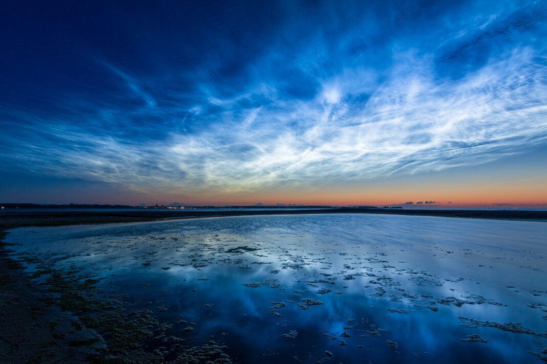
Noctilucent clouds (NLCs), also called night-shining clouds, are the highest clouds in the Earth’s atmosphere, forming in the mesosphere at altitudes of approximately 76 to 85 kilometres.

They are primarily composed of ice crystals and are visible during twilight hours when the Sun is below the horizon but illuminates these upper-atmosphere clouds.

Noctilucent clouds are largely restricted to high-latitude regions during the summer months and are indicators of extreme atmospheric conditions in the mesosphere.
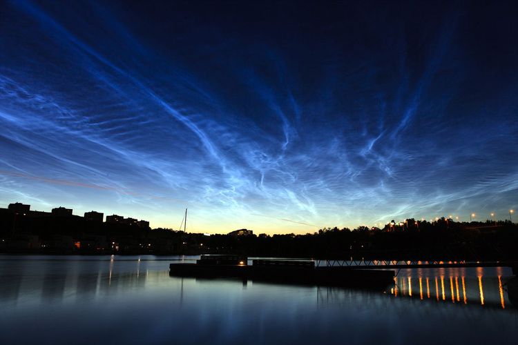
Noctilucent clouds over Solna in Stockholm, Sweden.

Characteristics of Noctilucent Clouds

  • Base Altitude: 76–85 kilometres, in the mesosphere, making them far higher than tropospheric clouds.
  • Top Altitude: They are relatively thin, with vertical extent typically less than a kilometre, forming thin, layered sheets.
  • Shape: Noctilucent clouds form wispy, filament-like structures often arranged in rippled or wave patterns. They can stretch horizontally over hundreds of kilometres.
  • Texture: They appear fibrous or finely detailed, with edges illuminated by scattered sunlight during twilight.
  • Colour: NLCs are generally bright silvery or bluish-white, and can sometimes show faint iridescent hues under optimal lighting.
  • Etymology: The term noctilucent comes from Latin, meaning “night shining”, reflecting their visibility during post-sunset or pre-sunrise twilight when lower clouds are in darkness.
  • Precipitation: Noctilucent clouds do not produce precipitation. The ice crystals are extremely small and exist in the very low-pressure, extremely cold mesosphere, where they cannot grow large enough to fall as rain or snow.
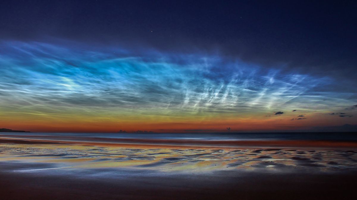
Noctilucent clouds form when water vapor freezes onto dust particles left by meteoroids high in the atmosphere.
Noctilucent clouds form when water vapor freezes onto dust particles left by meteoroids high in the atmosphere..

Formation and Dynamics

Noctilucent clouds form under very specific mesopheric conditions:

  1. Extremely low temperatures below −120°C, typical of polar mesospheric summer.
  2. Presence of water vapour, which is minimal at these altitudes but sufficient to condense onto meteoric dust particles.
  3. High-latitude summer sunlight, which illuminates the clouds from below the horizon.

Ice crystals in NLCs are typically 10–100 nanometres in diameter, forming from water vapour condensing on meteoric smoke particles. The mesospheric location exposes them to strong winds and gravity waves, which shape their rippling or wave-like patterns.
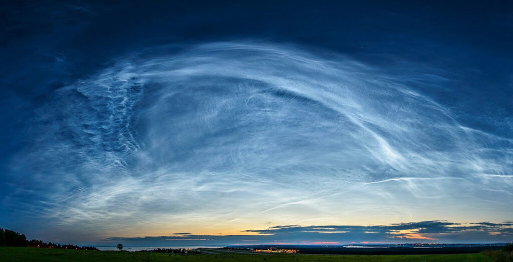
The milky glow of noctilucent clouds.

Historical Context

Noctilucent clouds were first recorded in 1885, shortly after the eruption of Krakatoa, although their regular formation in polar regions was only documented in the early 20th century.

Modern satellite observations, beginning with instruments like AIM (Aeronomy of Ice in the Mesosphere), have allowed detailed study of NLC frequency, distribution, and seasonal variability.

Their observation is limited to high latitudes (50°–70°) during summer months, when the geometry of sunlight relative to the mesosphere allows them to be illuminated against a darker sky.

Observations and Phenomena

  • Visibility: NLCs are seen after sunset or before sunrise in twilight conditions. Their high altitude allows them to remain illuminated while the lower atmosphere is in darkness.
  • Geographic Occurrence: Predominantly observed in polar and subpolar regions, including Scandinavia, Canada, Alaska, and Antarctica.
  • Wave Patterns: Gravity waves in the mesosphere create banded or rippled structures, giving the clouds a distinct textured appearance.
The milky glow of noctilucent clouds.

Distinguishing Noctilucent Clouds from Similar Clouds

  • Nacreous Clouds: Unlike nacreous clouds, which form in the stratosphere (15–25 km), NLCs form much higher in the mesosphere and only appear during polar summer twilight.
  • Cirrus Clouds: Cirrus clouds are tropospheric and lower in altitude, whereas NLCs exist in the upper mesosphere.
  • Kelvin-Helmholtz / Fluctus Clouds: These form in the troposphere and display wave-like features due to wind shear, while NLCs are ice crystal clouds illuminated from below.

Further Information

  • Scientific Importance: Noctilucent clouds are sensitive indicators of mesospheric temperature and water vapour content, and their occurrence may be influenced by climate change and anthropogenic effects.
  • Observation Techniques: Observed visually during twilight, photographed for scientific studies, and tracked by satellites such as AIM and Odin for global monitoring.
  • Seasonality: NLCs occur during high-latitude summer months, roughly from May to August in the Northern Hemisphere and November to February in the Southern Hemisphere.

Noctilucent clouds are extremely high-altitude, ice-crystal clouds forming in the mesosphere under very cold, low-pressure conditions.

Their appearance during twilight provides insight into mesospheric dynamics, water vapour content, and atmospheric wave phenomena.

They are a distinct and scientifically valuable feature of polar and subpolar skies, separate from stratospheric or tropospheric cloud types.

Tony S.
Tony is based in Australia and focuses on how false conspiracy theories spread and harm society, with an emphasis on clear facts and critical thinking.

Related

The Evolution of Cloud Classification

Historically, cloud classification began with the work of Luke Howard in 1803, who introduced the three primary forms: cirrus (curl), cumulus (heap), and stratus (layer). Since then, the system has evolved, integrating observations from aviation, photography, and satellite imaging, culminating in the current WMO framework.

Aerodynamic Wake Contrails, and Why They are Mistaken for Chemtrails

Aerodynamic wake contrails occur when air cools and condenses over aircraft wings, forming brief clouds of ice crystals. Often mistaken for “chemtrails,” these natural phenomena reveal how physics and perception intertwine, as psychological biases can turn ordinary aerodynamic effects into supposed evidence of deliberate atmospheric spraying.

The Sky Looks Different Nowadays

Chemtrail believers often argue that certain cloud types are “new” formations created by secret weather manipulation, yet this claim overlooks the long history of cloud observation. Many of the patterns they point to have been described and classified by meteorologists for decades, with some recorded in cloud atlases from the 19th and early 20th centuries.

10 Main Cloud Types

he ten major cloud types are divided into high-level, mid-level, low-level, and clouds with vertical development, reflecting their formation altitude and structure. Each type exhibits distinctive physical and visual characteristics and provides insight into the atmospheric processes at work.

Cirrostratus Clouds

Cirrostratus are high, veil-like ice-crystal clouds that spread diffusely and often produce halos around the sun or moon. They form under gentle ascent near warm fronts. Their name solidified in standard cloud atlases from the late 19th century, and they feature in halo folklore.

Special & Accessory Clouds

Not all clouds fit neatly into the ten main genera. Some appear as distinctive features or as by-products of atmospheric processes. These forms provide visual evidence of atmospheric motion or turbulence and are important signals for weather observers and forecasters.

Featured

Counting the Cost of a Nationwide Chemtrail Programme

What would it actually take to run a nationwide US “chemtrail” operation? Our analysis reveals the staggering logistics — 165 aircraft, thousands of workers, and billions of dollars each year. The numbers tell their own story.

Why Contrails Can Linger and Spread

Contrails can linger and spread because they are essentially man-made cirrus clouds formed from ice crystals at high altitude. A cloud is made of water vapour, just like a contrail. Therefore if a cloud can linger, so can a contrail. When an aircraft’s hot exhaust mixes with cold, humid air, the resulting condensation freezes, creating thin white trails.

The Logistics of Secrecy: The Impossible Scale of a Chemtrail Programme

This article examines the chemtrail conspiracy through physics, engineering, and economics. It shows that a nationwide spraying programme would require hundreds of aircraft, thousands of staff, and billions in funding—leaving clear evidence. The science of contrails fully explains the phenomenon without invoking any secret aerosol operation.

The chemtrail conspiracy would collapse within a few years

Physicist David Grimes’s 2016 mathematical model shows that large conspiracies such as Chemtrails inevitably unravel through leaks. His analysis demonstrates that a secret global spraying programme involving thousands of people over decades is statistically implausible.

Cloud Seeding: You can’t Just Make Rain

It is impossible to manufacture rain, which depends on water vapour in the atmosphere. This is supplied by heat and evaporation from the Earth’s surface. Only when moist air cools and condenses into clouds is there potential for rain. Techniques such as cloud seeding cannot create this water; they can only encourage raindrops to form in clouds that are already primed to produce rain.

Cloud Seeding is Not Chemtrails

Cloud seeding and so-called “chemtrails” are fundamentally different, though often confused in conspiracy circles. Cloud seeding is a small-scale, scientifically documented technique in which aircraft introduce minute amounts of silver iodide into existing clouds to encourage rainfall; it does not involve spraying chemicals into clear skies, nor does it leave visible white streaks. Chemtrails.

Popular Categories