

Atmospheric Wave Patterns in the Troposphere
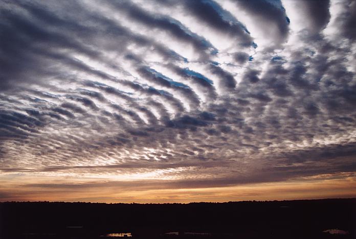
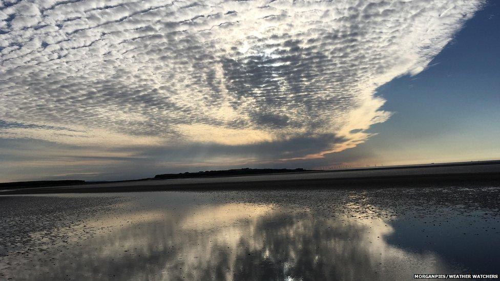
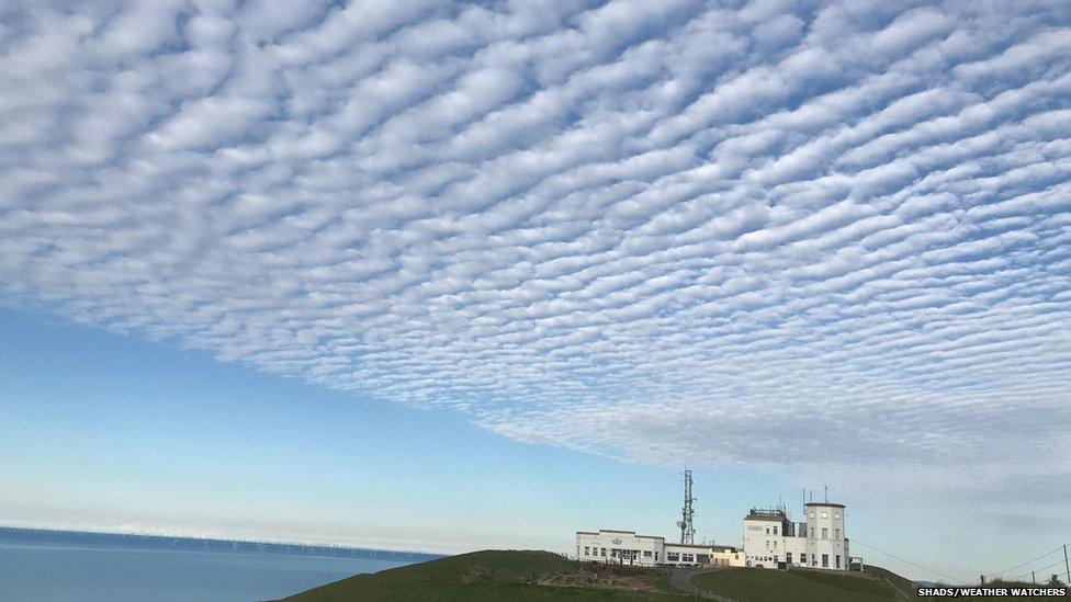
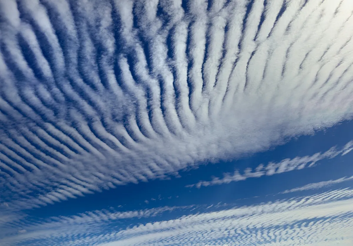
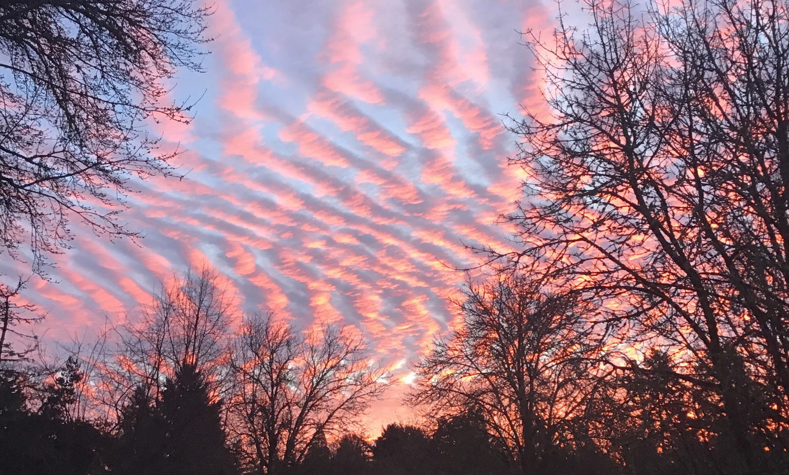
Undulatus clouds are a recognised cloud variety characterised by wave-like patterns across the sky. The term undulatus is Latin for “wavy,” reflecting the repeating bands or ripples these clouds display.
They are observed within multiple cloud genera, including Altocumulus, Stratocumulus, and Cirrocumulus.
Undulatus clouds are not a distinct genus; rather, the variety classification indicates the presence of periodic wave structures in the cloud layer, typically resulting from oscillatory motion in a stable portion of the atmosphere.
How Undulatus Clouds are Formed
The formation of undulatus patterns is governed by atmospheric gravity waves, which occur when air is vertically displaced in a stratified, stable layer and gravity acts as the restoring force.
Moisture and temperature profiles determine whether these waves are visible as cloud structures. Undulatus clouds are observed in mid-level altitudes (Altocumulus undulatus), low-level layers (Stratocumulus undulatus), and high-level layers (Cirrocumulus undulatus).
These clouds provide insight into atmospheric stability, wind shear, and energy transfer in the troposphere. They also serve as diagnostic indicators of local and regional weather conditions.
Misinterpretations of undulatus clouds occasionally appear in discussions of artificial weather modification, which require clarification.
Formation Mechanics
Undulatus clouds develop in stable atmospheric layers where vertical air movement is restricted. Stability in meteorology refers to a situation in which an air parcel, when displaced vertically, tends to return toward its original position. This occurs in layers with a temperature inversion or shallow lapse rate.
When a disturbance occurs, such as wind over terrain, frontal passage, or convective outflow, the air is forced to oscillate vertically.
If the layer contains sufficient moisture, the upward portion of the oscillation cools to the condensation point, producing cloud formation, while the downward portion warms and dries, resulting in clear gaps.
The result is alternating bands of cloud and clear sky, aligned with the direction of the wave propagation.
The variety of undulatus patterns reflects differences in cloud genus, altitude, and the amplitude and wavelength of the waves.
In Altocumulus undulatus, the spacing between bands is typically several hundred metres to a few kilometres.
In Stratocumulus undulatus, the spacing is often smaller, reflecting the shallower depth of the low-level layer. Cirrocumulus undulatus shows narrow, high-altitude ripples that indicate the presence of ice crystals rather than liquid droplets.
Wave Dynamics
The mechanism underlying undulatus clouds is the gravity wave, a well-documented phenomenon in fluid dynamics.
Gravity waves occur when a stable air layer is vertically displaced and the restoring force of gravity causes oscillations.
Unlike convective motions, which are driven by buoyancy and instability, gravity waves propagate through stratified air.
The vertical displacement of a parcel creates oscillations around its equilibrium position. Momentum carries the parcel beyond its initial level, generating a repetitive up-and-down motion.
If the air contains moisture, condensation occurs at wave crests, forming visible cloud bands, while evaporation occurs in the troughs, leaving clear sections.
The wavelength of atmospheric gravity waves can vary from hundreds of metres to tens of kilometres.
The frequency of oscillation is related to the Brunt–Väisälä frequency, which depends on the stability of the layer and the vertical temperature gradient.
Observed undulatus patterns in cloud layers provide a visual measure of these underlying atmospheric waves.
Wave amplification occurs under conditions of strong wind shear, where the difference in wind speed or direction with height increases oscillation amplitude.
In extreme cases, waves can break, producing turbulence or more complex cloud formations such as Asperitas.
Atmospheric Conditions
Undulatus clouds are most commonly found in regions with stable stratification and a consistent moisture layer. Typical environmental conditions include:
- Temperature inversions or layers of stable air that restrict vertical mixing.
- Wind shear, where wind speed or direction changes with altitude, reinforcing wave motion.
- Moisture at the condensation level, providing the necessary water content for visible clouds.
- Topographical triggers, such as wind flowing over hills or mountains, generating orographic waves.
- Frontal zones, particularly warm fronts, where moist air overrides cooler air, producing layered stratification.
The combination of these factors determines the orientation, wavelength, and persistence of undulatus patterns.
In satellite imagery, extensive undulating cloud fields are often observed downstream of mountain ranges or in areas of upper-level jet stream interaction.
Visual Characteristics and Classification
Undulatus patterns vary by cloud genus:
- Altocumulus undulatus: mid-level clouds, generally between 2,000 and 7,000 metres, displaying elongated, regularly spaced bands.
- Stratocumulus undulatus: low-level clouds, often 500 to 2,000 metres, showing smaller, tightly spaced ripples.
- Cirrocumulus undulatus: high-level, ice-crystal clouds above 6,000 metres, forming narrow, parallel ripples.
The regularity and alignment of the waves distinguishes undulatus clouds from other varieties, such as Asperitas (irregular, turbulent) or Lenticularis (isolated, lens-shaped). Radiatus, a different variety, refers to cloud bands that appear to converge in perspective, rather than being caused by atmospheric waves.
Undulatus clouds provide diagnostic information about the underlying atmospheric layer, including the orientation of upper-level winds and the spacing of waves relative to the Brunt–Väisälä frequency.
Physical Limits of EM Influence
Claims that undulatus clouds are produced by electromagnetic fields (EMFs) or HAARP-style transmitters are not physically supported.
Gravity waves, which produce undulatus clouds, operate in the troposphere, typically below 7 kilometres, while EMF facilities such as HAARP operate in the ionosphere, 60 to 1,000 kilometres above the surface.
The energy and wavelengths of EMFs are insufficient to displace air parcels on the scale necessary to generate waves in the troposphere.
The density of air at these altitudes, combined with the strength of natural restoring forces, makes external electromagnetic influence negligible.
Observations, modeling, and laboratory simulations consistently demonstrate that undulatus patterns arise from natural fluid-dynamic processes, not artificial electromagnetic sources.
Observational Evidence of Undulatus Clouds
Empirical evidence for undulatus clouds is extensive:
- Radiosonde and weather balloon data show temperature inversions and wind shear layers coinciding with observed wave clouds.
- Satellite imagery reveals large-scale parallel bands aligned with upper-level wind flow.
- Aircraft reports document smooth air oscillations consistent with gravity wave propagation.
- Numerical simulations replicate cloud band formation under stable, layered conditions.
These observations confirm the physical mechanisms described and provide a robust counterargument to claims of artificial cloud formation.
Significance of Undulatus Clouds to Meteorology
Undulatus clouds are important for multiple aspects of meteorology:
- Atmospheric stability: their presence indicates stratified layers that may trap pollutants or fog.
- Wind shear identification: patterns reveal shear zones that are relevant for aviation safety.
- Energy transfer: gravity waves transport momentum between layers, affecting local and regional circulation.
- Forecasting: the clouds indicate conditions relevant for precipitation, turbulence, and weather evolution.
They are thus both a visual indicator and a scientific tool for understanding atmospheric dynamics.
To Sum Up
Undulatus clouds result from gravity waves in stable layers of the troposphere. They occur across multiple cloud genera and altitudes, displaying characteristic wave patterns where air rises and condenses in some regions and sinks and evaporates in others.
These formations are entirely natural. Observational data, atmospheric physics, and fluid-dynamic principles demonstrate that they are not influenced by electromagnetic fields or HAARP-style transmitters.
Studying undulatus clouds provides insight into wave dynamics, atmospheric stability, and energy transfer, offering practical and theoretical value for meteorology.
")
