

Overview of Mammatus Clouds
Mammatus clouds are pouch-like protrusions hanging beneath the anvil of cumulonimbus clouds or, more rarely, other cloud types.
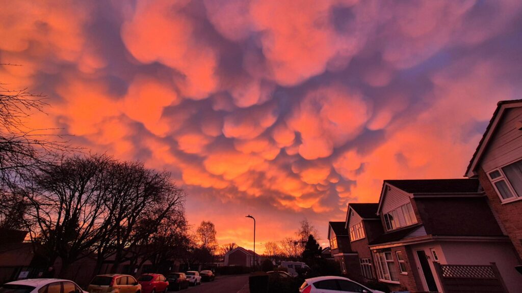
They mark areas of intense downdraft and are striking indicators of turbulent atmospheric processes.
Details
Height: Bases typically between 20,000 and 40,000 feet (6,000–12,000 metres).
Look: Rounded, pendulous lobes resembling clusters of udders or bubbles.
Name meaning: From Latin mamma, meaning “breast” or “udder.”
Rain: Usually associated with dissipating thunderstorms but rarely produce rainfall themselves.
What Do Mammatus Clouds Look Like
Seen from below, mammatus formations resemble fields of bulging sacs hanging from the underside of a storm’s anvil. They can appear grey, golden, or orange when illuminated by low-angle sunlight.
The contrast between their curved forms and the flat anvil base gives them a sculptural appearance.

A History of Mammatus Clouds
The phenomenon was first systematically described by William Clement Ley in the late 19th century and later analysed by American meteorologist Horace Byers during the 1940s.
Mammatus features have appeared in numerous artworks depicting dramatic skies, including paintings of tempestuous scenes from the Romantic period.
Further Information
The formation of mammatus is linked to sinking air laden with ice crystals or precipitation particles that evaporate, cooling the air and enhancing descent.
This process contrasts with most clouds, which form in rising air. High-resolution satellite imagery reveals mammatus fields extending tens of kilometres.
Their appearance often signifies mature or decaying convective systems, though they are not direct indicators of severe weather at ground level. Temperature inversions and variations in liquid water content control the clarity and persistence of the lobes.

